You are here: Home > Network List > TA - USArray Transportable Network (new EarthScope stations) Stations List
> Station G21K Allakaket, AK, USA > Earthquake Result Viewer
G21K Allakaket, AK, USA - Earthquake Result Viewer

| Earthquake location: |
North Korea |
| Earthquake latitude/longitude: |
41.3/129.0 |
| Earthquake time(UTC): |
2017/09/03 (246) 03:30:01 GMT |
| Earthquake Depth: |
0.0 km |
| Earthquake Magnitude: |
6.3 mb |
| Earthquake Catalog/Contributor: |
NEIC PDE/us |
|
| Network: |
TA USArray Transportable Network (new EarthScope stations) |
| Station: |
G21K Allakaket, AK, USA |
| Lat/Lon: |
66.52 N/153.51 W |
| Elevation: |
446 m |
|
| Distance: |
48.1 deg |
| Az: |
31.733 deg |
| Baz: |
278.81 deg |
| Ray Param: |
0.06962737 |
| Estimated Moho Depth: |
64.75 km |
| Estimated Crust Vp/Vs: |
1.84 |
| Assumed Crust Vp: |
6.455 km/s |
| Estimated Crust Vs: |
3.508 km/s |
| Estimated Crust Poisson's Ratio: |
0.29 |
|
| Radial Match: |
82.90233 % |
| Radial Bump: |
400 |
| Transverse Match: |
77.45409 % |
| Transverse Bump: |
400 |
| SOD ConfigId: |
13570011 |
| Insert Time: |
2019-04-28 16:40:08.010 +0000 |
| GWidth: |
2.5 |
| Max Bumps: |
400 |
| Tol: |
0.001 |
|
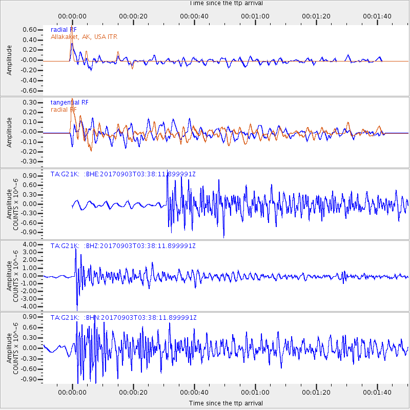
Signal To Noise
| Channel | StoN | STA | LTA |
| TA:G21K: :BHZ:20170903T03:38:11.899991Z | 19.838045 | 1.5193076E-6 | 7.658554E-8 |
| TA:G21K: :BHN:20170903T03:38:11.899991Z | 6.304732 | 3.901357E-7 | 6.1879824E-8 |
| TA:G21K: :BHE:20170903T03:38:11.899991Z | 5.5134697 | 3.957704E-7 | 7.178246E-8 |
| Arrivals |
| Ps | 8.9 SECOND |
| PpPs | 27 SECOND |
| PsPs/PpSs | 36 SECOND |


