P12A McGill, NV, USA - Earthquake Result Viewer
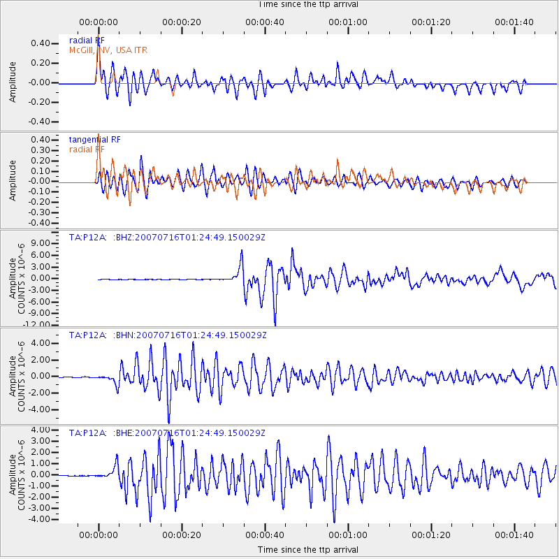
Earthquake location: Near West Coast Of Honshu, Japan
Earthquake latitude/longitude: 37.5/138.4
Earthquake time(UTC): 2007/07/16 (197) 01:13:22 GMT
Earthquake Depth: 12 km
Earthquake Magnitude: 6.5 MB, 6.4 MS, 6.6 MW, 6.5 MW
Earthquake Catalog/Contributor: WHDF/NEIC
Network: TA USArray Transportable Network (new EarthScope stations)
Station: P12A McGill, NV, USA
Lat/Lon: 39.47 N/114.91 W
Elevation: 1878 m
Distance: 78.0 deg
Az: 49.3 deg
Baz: 308.863 deg
Ray Param: 0.049934182
Estimated Moho Depth: 35.75 km
Estimated Crust Vp/Vs: 1.60
Assumed Crust Vp: 6.276 km/s
Estimated Crust Vs: 3.916 km/s
Estimated Crust Poisson's Ratio: 0.18
Radial Match: 95.124825 %
Radial Bump: 400
Transverse Match: 89.72887 %
Transverse Bump: 400
SOD ConfigId: 2564
Insert Time: 2010-03-06 03:17:24.440 +0000
GWidth: 2.5
Max Bumps: 400
Tol: 0.001

Signal To Noise

ChannelStoNSTALTA
TA:P12A: :BHN:20070716T01:24:49.150029Z16.5294936.0619726E-73.6673676E-8
TA:P12A: :BHE:20070716T01:24:49.150029Z16.3868876.234393E-73.804501E-8
TA:P12A: :BHZ:20070716T01:24:49.150029Z49.0183682.3812668E-64.857907E-8
Arrivals
Ps3.5 SECOND
PpPs14 SECOND
PsPs/PpSs18 SECOND