P12A McGill, NV, USA - Earthquake Result Viewer
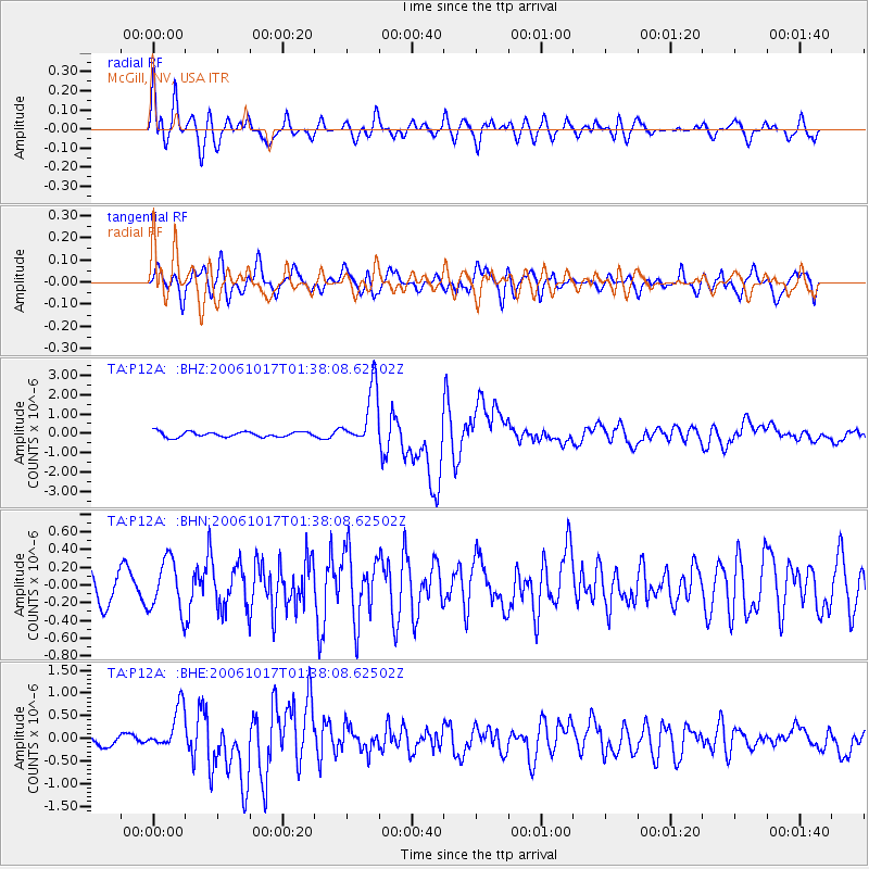
Earthquake location: New Britain Region, P.N.G.
Earthquake latitude/longitude: -5.9/151.0
Earthquake time(UTC): 2006/10/17 (290) 01:25:12 GMT
Earthquake Depth: 32 km
Earthquake Magnitude: 6.4 MB, 6.9 MS, 6.7 MW, 6.6 MW
Earthquake Catalog/Contributor: WHDF/NEIC
Network: TA USArray Transportable Network (new EarthScope stations)
Station: P12A McGill, NV, USA
Lat/Lon: 39.47 N/114.91 W
Elevation: 1878 m
Distance: 96.9 deg
Az: 51.042 deg
Baz: 268.059 deg
Ray Param: 0.04036966
Estimated Moho Depth: 36.25 km
Estimated Crust Vp/Vs: 1.60
Assumed Crust Vp: 6.276 km/s
Estimated Crust Vs: 3.922 km/s
Estimated Crust Poisson's Ratio: 0.18
Radial Match: 88.86276 %
Radial Bump: 400
Transverse Match: 73.896484 %
Transverse Bump: 400
SOD ConfigId: 2665
Insert Time: 2010-03-06 03:18:00.401 +0000
GWidth: 2.5
Max Bumps: 400
Tol: 0.001

Signal To Noise

ChannelStoNSTALTA
TA:P12A: :BHN:20061017T01:38:08.62502Z1.31284222.8985608E-72.2078515E-7
TA:P12A: :BHE:20061017T01:38:08.62502Z2.70620184.676137E-71.7279335E-7
TA:P12A: :BHZ:20061017T01:38:08.62502Z11.2437941.5104929E-61.3434014E-7
Arrivals
Ps3.5 SECOND
PpPs15 SECOND
PsPs/PpSs18 SECOND