You are here: Home > Network List > TA - USArray Transportable Network (new EarthScope stations) Stations List
> Station J23A Dilts Ranch, Bill, WY, USA > Earthquake Result Viewer
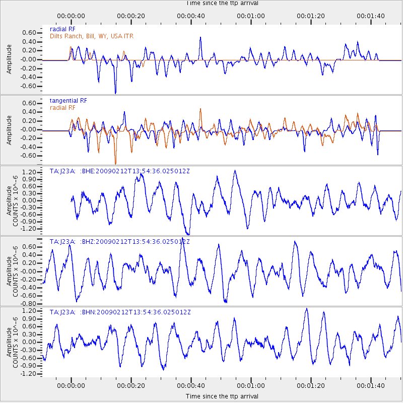
J23A Dilts Ranch, Bill, WY, USA - Earthquake Result Viewer
*The percent match for this event was below the threshold and hence no stack was calculated.
| Earthquake location: |
South Of Mariana Islands |
| Earthquake latitude/longitude: |
12.1/143.8 |
| Earthquake time(UTC): |
2009/02/12 (043) 13:41:43 GMT |
| Earthquake Depth: |
40 km |
| Earthquake Magnitude: |
5.5 MB |
| Earthquake Catalog/Contributor: |
WHDF/NEIC |
|
| Network: |
TA USArray Transportable Network (new EarthScope stations) |
| Station: |
J23A Dilts Ranch, Bill, WY, USA |
| Lat/Lon: |
43.40 N/105.55 W |
| Elevation: |
1499 m |
|
| Distance: |
96.2 deg |
| Az: |
43.308 deg |
| Baz: |
293.027 deg |
| Ray Param: |
$rayparam |
*The percent match for this event was below the threshold and hence was not used in the summary stack. |
|
| Radial Match: |
51.690548 % |
| Radial Bump: |
400 |
| Transverse Match: |
56.219284 % |
| Transverse Bump: |
400 |
| SOD ConfigId: |
2658 |
| Insert Time: |
2010-03-06 03:21:03.293 +0000 |
| GWidth: |
2.5 |
| Max Bumps: |
400 |
| Tol: |
0.001 |
|
Signal To Noise
| Channel | StoN | STA | LTA |
| TA:J23A: :BHZ:20090212T13:54:36.025012Z | 2.476291 | 4.7682587E-7 | 1.9255647E-7 |
| TA:J23A: :BHN:20090212T13:54:36.025012Z | 0.4427214 | 1.9797795E-7 | 4.4718405E-7 |
| TA:J23A: :BHE:20090212T13:54:36.025012Z | 1.0413531 | 5.426316E-7 | 5.210832E-7 |
| Arrivals |
| Ps | |
| PpPs | |
| PsPs/PpSs | |


