You are here: Home > Network List > CI - Caltech Regional Seismic Network Stations List
> Station MPM Manuel Prospect Mine, California, USA > Earthquake Result Viewer
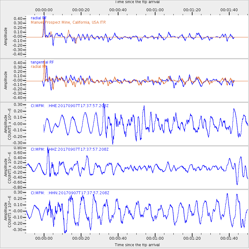
MPM Manuel Prospect Mine, California, USA - Earthquake Result Viewer
*The percent match for this event was below the threshold and hence no stack was calculated.
| Earthquake location: |
Bonin Islands, Japan Region |
| Earthquake latitude/longitude: |
27.8/139.8 |
| Earthquake time(UTC): |
2017/09/07 (250) 17:26:49 GMT |
| Earthquake Depth: |
448 km |
| Earthquake Magnitude: |
6.1 Mww |
| Earthquake Catalog/Contributor: |
NEIC PDE/us |
|
| Network: |
CI Caltech Regional Seismic Network |
| Station: |
MPM Manuel Prospect Mine, California, USA |
| Lat/Lon: |
36.06 N/117.49 W |
| Elevation: |
185 m |
|
| Distance: |
83.5 deg |
| Az: |
52.715 deg |
| Baz: |
299.528 deg |
| Ray Param: |
$rayparam |
*The percent match for this event was below the threshold and hence was not used in the summary stack. |
|
| Radial Match: |
65.29275 % |
| Radial Bump: |
340 |
| Transverse Match: |
63.491253 % |
| Transverse Bump: |
400 |
| SOD ConfigId: |
13570011 |
| Insert Time: |
2019-04-28 17:11:23.307 +0000 |
| GWidth: |
2.5 |
| Max Bumps: |
400 |
| Tol: |
0.001 |
|
Signal To Noise
| Channel | StoN | STA | LTA |
| CI:MPM: :HHZ:20170907T17:37:57.208Z | 3.1655004 | 3.3197819E-7 | 1.0487384E-7 |
| CI:MPM: :HHN:20170907T17:37:57.208Z | 1.0541986 | 7.1495094E-8 | 6.781938E-8 |
| CI:MPM: :HHE:20170907T17:37:57.208Z | 1.6336751 | 1.5384552E-7 | 9.417143E-8 |
| Arrivals |
| Ps | |
| PpPs | |
| PsPs/PpSs | |


