You are here: Home > Network List > CI - Caltech Regional Seismic Network Stations List
> Station MPP McPhearson Peak > Earthquake Result Viewer
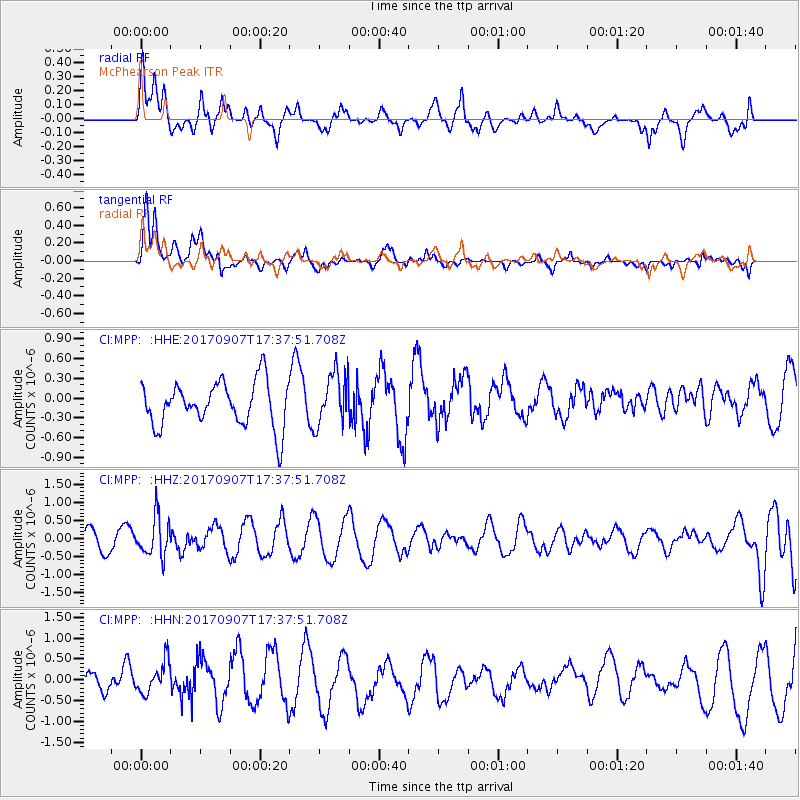
MPP McPhearson Peak - Earthquake Result Viewer
*The percent match for this event was below the threshold and hence no stack was calculated.
| Earthquake location: |
Bonin Islands, Japan Region |
| Earthquake latitude/longitude: |
27.8/139.8 |
| Earthquake time(UTC): |
2017/09/07 (250) 17:26:49 GMT |
| Earthquake Depth: |
448 km |
| Earthquake Magnitude: |
6.1 Mww |
| Earthquake Catalog/Contributor: |
NEIC PDE/us |
|
| Network: |
CI Caltech Regional Seismic Network |
| Station: |
MPP McPhearson Peak |
| Lat/Lon: |
34.89 N/119.81 W |
| Elevation: |
1739 m |
|
| Distance: |
82.4 deg |
| Az: |
54.67 deg |
| Baz: |
298.425 deg |
| Ray Param: |
$rayparam |
*The percent match for this event was below the threshold and hence was not used in the summary stack. |
|
| Radial Match: |
47.880444 % |
| Radial Bump: |
400 |
| Transverse Match: |
60.40004 % |
| Transverse Bump: |
400 |
| SOD ConfigId: |
13570011 |
| Insert Time: |
2019-04-28 17:11:23.430 +0000 |
| GWidth: |
2.5 |
| Max Bumps: |
400 |
| Tol: |
0.001 |
|
Signal To Noise
| Channel | StoN | STA | LTA |
| CI:MPP: :HHZ:20170907T17:37:51.708Z | 1.9403197 | 5.402968E-7 | 2.784576E-7 |
| CI:MPP: :HHN:20170907T17:37:51.708Z | 1.6292934 | 3.8850317E-7 | 2.3844885E-7 |
| CI:MPP: :HHE:20170907T17:37:51.708Z | 1.1799134 | 4.0030156E-7 | 3.3926352E-7 |
| Arrivals |
| Ps | |
| PpPs | |
| PsPs/PpSs | |


