You are here: Home > Network List > CI - Caltech Regional Seismic Network Stations List
> Station TUQ Turquiose Mountain, Baker, CA, USA > Earthquake Result Viewer
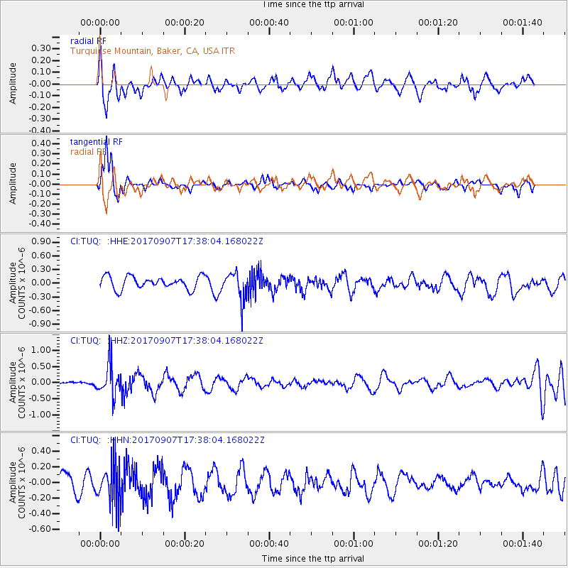
TUQ Turquiose Mountain, Baker, CA, USA - Earthquake Result Viewer
*The percent match for this event was below the threshold and hence no stack was calculated.
| Earthquake location: |
Bonin Islands, Japan Region |
| Earthquake latitude/longitude: |
27.8/139.8 |
| Earthquake time(UTC): |
2017/09/07 (250) 17:26:49 GMT |
| Earthquake Depth: |
448 km |
| Earthquake Magnitude: |
6.1 Mww |
| Earthquake Catalog/Contributor: |
NEIC PDE/us |
|
| Network: |
CI Caltech Regional Seismic Network |
| Station: |
TUQ Turquiose Mountain, Baker, CA, USA |
| Lat/Lon: |
35.44 N/115.92 W |
| Elevation: |
1350 m |
|
| Distance: |
84.9 deg |
| Az: |
52.616 deg |
| Baz: |
300.428 deg |
| Ray Param: |
$rayparam |
*The percent match for this event was below the threshold and hence was not used in the summary stack. |
|
| Radial Match: |
52.554733 % |
| Radial Bump: |
400 |
| Transverse Match: |
79.39655 % |
| Transverse Bump: |
250 |
| SOD ConfigId: |
13570011 |
| Insert Time: |
2019-04-28 17:11:39.569 +0000 |
| GWidth: |
2.5 |
| Max Bumps: |
400 |
| Tol: |
0.001 |
|
Signal To Noise
| Channel | StoN | STA | LTA |
| CI:TUQ: :HHZ:20170907T17:38:04.168022Z | 7.701333 | 4.8899426E-7 | 6.349475E-8 |
| CI:TUQ: :HHN:20170907T17:38:04.168022Z | 2.5020335 | 2.5833032E-7 | 1.0324814E-7 |
| CI:TUQ: :HHE:20170907T17:38:04.168022Z | 2.220058 | 3.0555827E-7 | 1.3763527E-7 |
| Arrivals |
| Ps | |
| PpPs | |
| PsPs/PpSs | |


