You are here: Home > Network List > TA - USArray Transportable Network (new EarthScope stations) Stations List
> Station D25K Kavik River, AK, USA > Earthquake Result Viewer
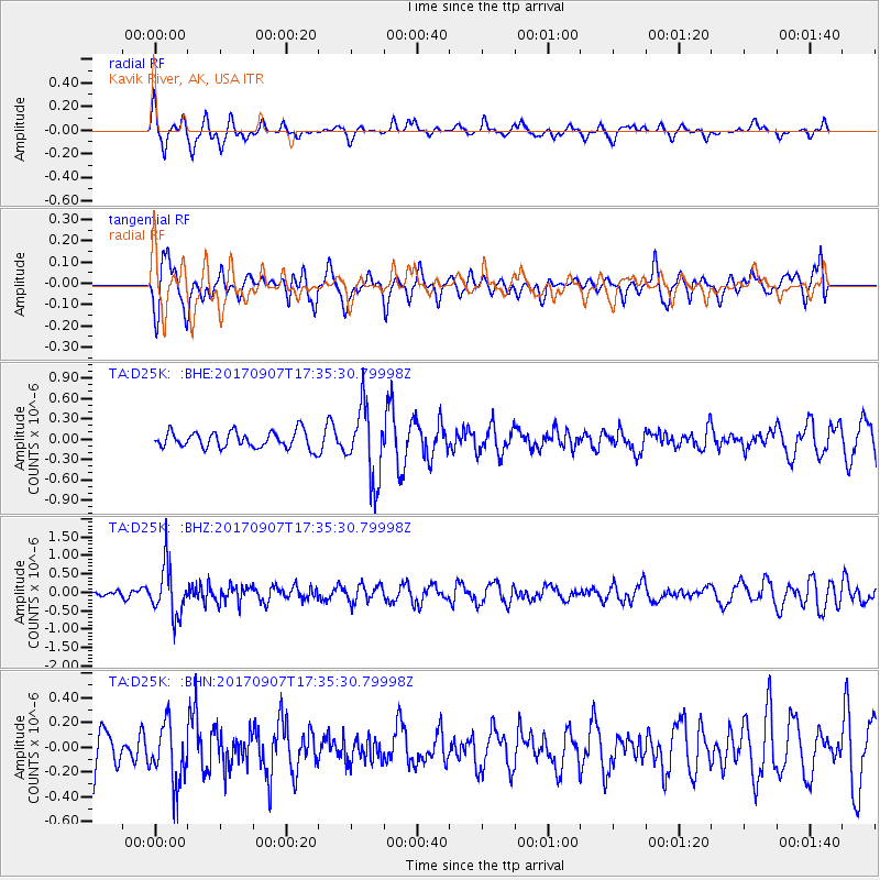
D25K Kavik River, AK, USA - Earthquake Result Viewer
*The percent match for this event was below the threshold and hence no stack was calculated.
| Earthquake location: |
Bonin Islands, Japan Region |
| Earthquake latitude/longitude: |
27.8/139.8 |
| Earthquake time(UTC): |
2017/09/07 (250) 17:26:49 GMT |
| Earthquake Depth: |
448 km |
| Earthquake Magnitude: |
6.1 Mww |
| Earthquake Catalog/Contributor: |
NEIC PDE/us |
|
| Network: |
TA USArray Transportable Network (new EarthScope stations) |
| Station: |
D25K Kavik River, AK, USA |
| Lat/Lon: |
69.32 N/146.38 W |
| Elevation: |
770 m |
|
| Distance: |
58.6 deg |
| Az: |
23.554 deg |
| Baz: |
265.544 deg |
| Ray Param: |
$rayparam |
*The percent match for this event was below the threshold and hence was not used in the summary stack. |
|
| Radial Match: |
59.067825 % |
| Radial Bump: |
335 |
| Transverse Match: |
63.68813 % |
| Transverse Bump: |
400 |
| SOD ConfigId: |
13570011 |
| Insert Time: |
2019-04-28 17:16:08.697 +0000 |
| GWidth: |
2.5 |
| Max Bumps: |
400 |
| Tol: |
0.001 |
|
Signal To Noise
| Channel | StoN | STA | LTA |
| TA:D25K: :BHZ:20170907T17:35:30.79998Z | 4.152968 | 6.719737E-7 | 1.6180564E-7 |
| TA:D25K: :BHN:20170907T17:35:30.79998Z | 1.2433876 | 2.4106635E-7 | 1.9387868E-7 |
| TA:D25K: :BHE:20170907T17:35:30.79998Z | 4.2073493 | 5.1747577E-7 | 1.229933E-7 |
| Arrivals |
| Ps | |
| PpPs | |
| PsPs/PpSs | |


