You are here: Home > Network List > TA - USArray Transportable Network (new EarthScope stations) Stations List
> Station F21K Alatna River, AK, USA > Earthquake Result Viewer
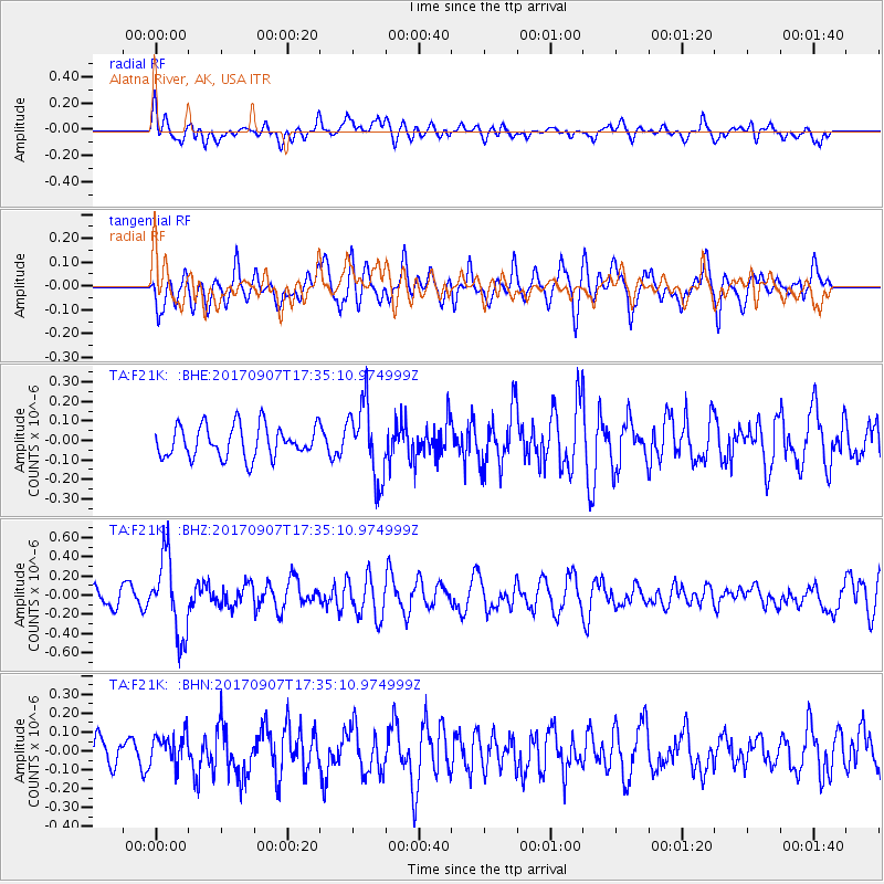
F21K Alatna River, AK, USA - Earthquake Result Viewer
*The percent match for this event was below the threshold and hence no stack was calculated.
| Earthquake location: |
Bonin Islands, Japan Region |
| Earthquake latitude/longitude: |
27.8/139.8 |
| Earthquake time(UTC): |
2017/09/07 (250) 17:26:49 GMT |
| Earthquake Depth: |
448 km |
| Earthquake Magnitude: |
6.1 Mww |
| Earthquake Catalog/Contributor: |
NEIC PDE/us |
|
| Network: |
TA USArray Transportable Network (new EarthScope stations) |
| Station: |
F21K Alatna River, AK, USA |
| Lat/Lon: |
67.22 N/153.48 W |
| Elevation: |
597 m |
|
| Distance: |
55.7 deg |
| Az: |
25.647 deg |
| Baz: |
260.08 deg |
| Ray Param: |
$rayparam |
*The percent match for this event was below the threshold and hence was not used in the summary stack. |
|
| Radial Match: |
46.446335 % |
| Radial Bump: |
400 |
| Transverse Match: |
54.41563 % |
| Transverse Bump: |
400 |
| SOD ConfigId: |
13570011 |
| Insert Time: |
2019-04-28 17:16:22.987 +0000 |
| GWidth: |
2.5 |
| Max Bumps: |
400 |
| Tol: |
0.001 |
|
Signal To Noise
| Channel | StoN | STA | LTA |
| TA:F21K: :BHZ:20170907T17:35:10.974999Z | 3.49945 | 4.0669428E-7 | 1.1621663E-7 |
| TA:F21K: :BHN:20170907T17:35:10.974999Z | 0.6646015 | 7.930186E-8 | 1.1932242E-7 |
| TA:F21K: :BHE:20170907T17:35:10.974999Z | 2.3519807 | 1.9293337E-7 | 8.203016E-8 |
| Arrivals |
| Ps | |
| PpPs | |
| PsPs/PpSs | |


