You are here: Home > Network List > TA - USArray Transportable Network (new EarthScope stations) Stations List
> Station G23K Bananza Creek, AK, USA > Earthquake Result Viewer
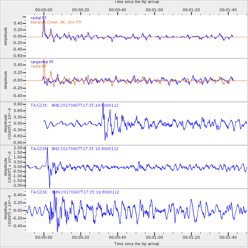
G23K Bananza Creek, AK, USA - Earthquake Result Viewer
*The percent match for this event was below the threshold and hence no stack was calculated.
| Earthquake location: |
Bonin Islands, Japan Region |
| Earthquake latitude/longitude: |
27.8/139.8 |
| Earthquake time(UTC): |
2017/09/07 (250) 17:26:49 GMT |
| Earthquake Depth: |
448 km |
| Earthquake Magnitude: |
6.1 Mww |
| Earthquake Catalog/Contributor: |
NEIC PDE/us |
|
| Network: |
TA USArray Transportable Network (new EarthScope stations) |
| Station: |
G23K Bananza Creek, AK, USA |
| Lat/Lon: |
66.71 N/150.02 W |
| Elevation: |
746 m |
|
| Distance: |
57.0 deg |
| Az: |
26.488 deg |
| Baz: |
263.726 deg |
| Ray Param: |
$rayparam |
*The percent match for this event was below the threshold and hence was not used in the summary stack. |
|
| Radial Match: |
77.19603 % |
| Radial Bump: |
344 |
| Transverse Match: |
51.16102 % |
| Transverse Bump: |
400 |
| SOD ConfigId: |
13570011 |
| Insert Time: |
2019-04-28 17:16:32.871 +0000 |
| GWidth: |
2.5 |
| Max Bumps: |
400 |
| Tol: |
0.001 |
|
Signal To Noise
| Channel | StoN | STA | LTA |
| TA:G23K: :BHZ:20170907T17:35:19.800011Z | 7.6442585 | 7.998029E-7 | 1.0462792E-7 |
| TA:G23K: :BHN:20170907T17:35:19.800011Z | 1.323886 | 1.2140067E-7 | 9.1700244E-8 |
| TA:G23K: :BHE:20170907T17:35:19.800011Z | 4.8404355 | 3.9527507E-7 | 8.166106E-8 |
| Arrivals |
| Ps | |
| PpPs | |
| PsPs/PpSs | |


