You are here: Home > Network List > TA - USArray Transportable Network (new EarthScope stations) Stations List
> Station M31M Drury Creek, Yukon, CA > Earthquake Result Viewer
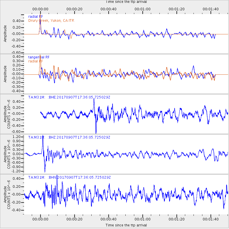
M31M Drury Creek, Yukon, CA - Earthquake Result Viewer
*The percent match for this event was below the threshold and hence no stack was calculated.
| Earthquake location: |
Bonin Islands, Japan Region |
| Earthquake latitude/longitude: |
27.8/139.8 |
| Earthquake time(UTC): |
2017/09/07 (250) 17:26:49 GMT |
| Earthquake Depth: |
448 km |
| Earthquake Magnitude: |
6.1 Mww |
| Earthquake Catalog/Contributor: |
NEIC PDE/us |
|
| Network: |
TA USArray Transportable Network (new EarthScope stations) |
| Station: |
M31M Drury Creek, Yukon, CA |
| Lat/Lon: |
62.20 N/134.39 W |
| Elevation: |
639 m |
|
| Distance: |
63.9 deg |
| Az: |
31.371 deg |
| Baz: |
280.255 deg |
| Ray Param: |
$rayparam |
*The percent match for this event was below the threshold and hence was not used in the summary stack. |
|
| Radial Match: |
64.80099 % |
| Radial Bump: |
400 |
| Transverse Match: |
65.75212 % |
| Transverse Bump: |
400 |
| SOD ConfigId: |
13570011 |
| Insert Time: |
2019-04-28 17:17:27.185 +0000 |
| GWidth: |
2.5 |
| Max Bumps: |
400 |
| Tol: |
0.001 |
|
Signal To Noise
| Channel | StoN | STA | LTA |
| TA:M31M: :BHZ:20170907T17:36:05.725029Z | 7.182603 | 5.003861E-7 | 6.966639E-8 |
| TA:M31M: :BHN:20170907T17:36:05.725029Z | 2.5448198 | 1.2941457E-7 | 5.085412E-8 |
| TA:M31M: :BHE:20170907T17:36:05.725029Z | 3.3860626 | 2.3324368E-7 | 6.888345E-8 |
| Arrivals |
| Ps | |
| PpPs | |
| PsPs/PpSs | |


