I12A Atlanta, ID, USA - Earthquake Result Viewer
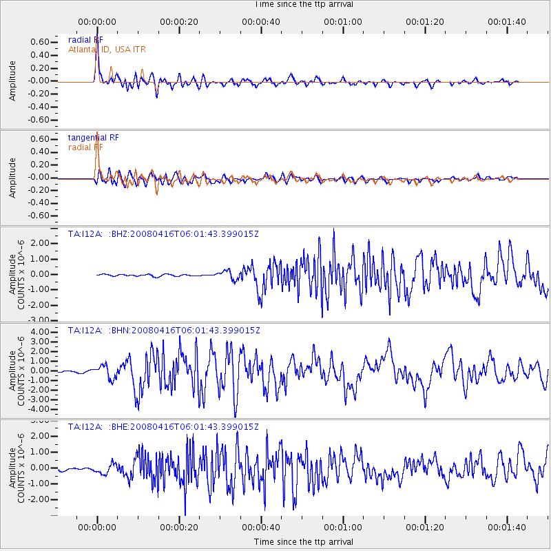
Earthquake location: Andreanof Islands, Aleutian Is.
Earthquake latitude/longitude: 51.9/-179.2
Earthquake time(UTC): 2008/04/16 (107) 05:54:19 GMT
Earthquake Depth: 13 km
Earthquake Magnitude: 6.1 MB, 6.5 MS, 6.6 MW, 6.6 MW
Earthquake Catalog/Contributor: WHDF/NEIC
Network: TA USArray Transportable Network (new EarthScope stations)
Station: I12A Atlanta, ID, USA
Lat/Lon: 43.79 N/115.13 W
Elevation: 1849 m
Distance: 42.5 deg
Az: 74.65 deg
Baz: 304.36 deg
Ray Param: 0.07315287
Estimated Moho Depth: 30.5 km
Estimated Crust Vp/Vs: 1.96
Assumed Crust Vp: 6.291 km/s
Estimated Crust Vs: 3.218 km/s
Estimated Crust Poisson's Ratio: 0.32
Radial Match: 87.75941 %
Radial Bump: 400
Transverse Match: 82.93488 %
Transverse Bump: 400
SOD ConfigId: 2504
Insert Time: 2010-03-06 03:26:35.523 +0000
GWidth: 2.5
Max Bumps: 400
Tol: 0.001

Signal To Noise

ChannelStoNSTALTA
TA:I12A: :BHN:20080416T06:01:43.399015Z7.17801486.878947E-79.5833556E-8
TA:I12A: :BHE:20080416T06:01:43.399015Z2.75638152.9893954E-71.0845362E-7
TA:I12A: :BHZ:20080416T06:01:43.399015Z4.97933242.8384684E-75.7005003E-8
Arrivals
Ps4.9 SECOND
PpPs14 SECOND
PsPs/PpSs18 SECOND