I12A Atlanta, ID, USA - Earthquake Result Viewer
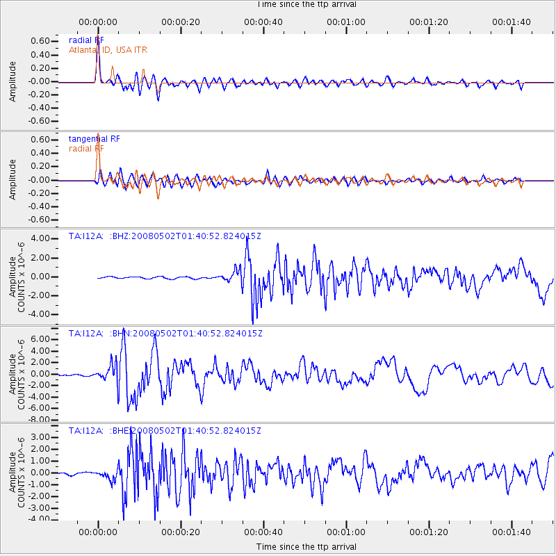
Earthquake location: Andreanof Islands, Aleutian Is.
Earthquake latitude/longitude: 51.9/-177.5
Earthquake time(UTC): 2008/05/02 (123) 01:33:37 GMT
Earthquake Depth: 14 km
Earthquake Magnitude: 6.3 MB, 6.8 MS, 6.6 MW, 6.6 MW
Earthquake Catalog/Contributor: WHDF/NEIC
Network: TA USArray Transportable Network (new EarthScope stations)
Station: I12A Atlanta, ID, USA
Lat/Lon: 43.79 N/115.13 W
Elevation: 1849 m
Distance: 41.5 deg
Az: 75.63 deg
Baz: 303.95 deg
Ray Param: 0.07375113
Estimated Moho Depth: 30.0 km
Estimated Crust Vp/Vs: 1.61
Assumed Crust Vp: 6.291 km/s
Estimated Crust Vs: 3.908 km/s
Estimated Crust Poisson's Ratio: 0.19
Radial Match: 86.11248 %
Radial Bump: 400
Transverse Match: 86.438705 %
Transverse Bump: 400
SOD ConfigId: 2504
Insert Time: 2010-03-06 03:26:37.140 +0000
GWidth: 2.5
Max Bumps: 400
Tol: 0.001

Signal To Noise

ChannelStoNSTALTA
TA:I12A: :BHN:20080502T01:40:52.824015Z14.3107851.5204449E-61.0624469E-7
TA:I12A: :BHE:20080502T01:40:52.824015Z3.61586384.42479E-71.2237159E-7
TA:I12A: :BHZ:20080502T01:40:52.824015Z6.0339776.1337903E-71.01654194E-7
Arrivals
Ps3.1 SECOND
PpPs12 SECOND
PsPs/PpSs15 SECOND