I12A Atlanta, ID, USA - Earthquake Result Viewer
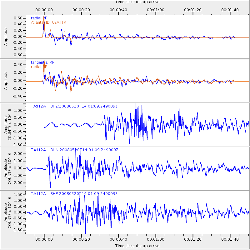
Earthquake location: Rat Islands, Aleutian Islands
Earthquake latitude/longitude: 51.2/178.8
Earthquake time(UTC): 2008/05/20 (141) 13:53:35 GMT
Earthquake Depth: 27 km
Earthquake Magnitude: 5.8 MB, 6.0 MS, 6.3 MW, 6.3 MW
Earthquake Catalog/Contributor: WHDF/NEIC
Network: TA USArray Transportable Network (new EarthScope stations)
Station: I12A Atlanta, ID, USA
Lat/Lon: 43.79 N/115.13 W
Elevation: 1849 m
Distance: 43.9 deg
Az: 72.685 deg
Baz: 303.887 deg
Ray Param: 0.07219574
Estimated Moho Depth: 23.25 km
Estimated Crust Vp/Vs: 1.74
Assumed Crust Vp: 6.291 km/s
Estimated Crust Vs: 3.616 km/s
Estimated Crust Poisson's Ratio: 0.25
Radial Match: 82.14586 %
Radial Bump: 400
Transverse Match: 77.652084 %
Transverse Bump: 400
SOD ConfigId: 2504
Insert Time: 2010-03-06 03:26:41.985 +0000
GWidth: 2.5
Max Bumps: 400
Tol: 0.001

Signal To Noise

ChannelStoNSTALTA
TA:I12A: :BHN:20080520T14:01:09.249009Z3.76606829.14111E-72.427229E-7
TA:I12A: :BHE:20080520T14:01:09.249009Z1.33823552.3478259E-71.754419E-7
TA:I12A: :BHZ:20080520T14:01:09.249009Z4.41900834.0586204E-79.1844605E-8
Arrivals
Ps2.9 SECOND
PpPs9.5 SECOND
PsPs/PpSs12 SECOND