I12A Atlanta, ID, USA - Earthquake Result Viewer
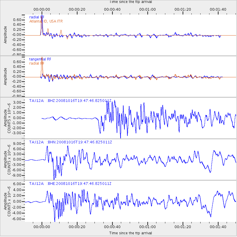
Earthquake location: Near Coast Of Chiapas, Mexico
Earthquake latitude/longitude: 14.4/-92.4
Earthquake time(UTC): 2008/10/16 (290) 19:41:25 GMT
Earthquake Depth: 24 km
Earthquake Magnitude: 6.1 MB, 6.6 MS, 6.7 MW, 6.6 MW
Earthquake Catalog/Contributor: WHDF/NEIC
Network: TA USArray Transportable Network (new EarthScope stations)
Station: I12A Atlanta, ID, USA
Lat/Lon: 43.79 N/115.13 W
Elevation: 1849 m
Distance: 35.2 deg
Az: 330.871 deg
Baz: 139.361 deg
Ray Param: 0.077338584
Estimated Moho Depth: 13.25 km
Estimated Crust Vp/Vs: 1.60
Assumed Crust Vp: 6.291 km/s
Estimated Crust Vs: 3.926 km/s
Estimated Crust Poisson's Ratio: 0.18
Radial Match: 92.363335 %
Radial Bump: 346
Transverse Match: 79.4878 %
Transverse Bump: 400
SOD ConfigId: 2556
Insert Time: 2010-03-06 03:27:20.320 +0000
GWidth: 2.5
Max Bumps: 400
Tol: 0.001

Signal To Noise

ChannelStoNSTALTA
TA:I12A: :BHN:20081016T19:47:46.825011Z19.1778983.1326563E-61.6334722E-7
TA:I12A: :BHE:20081016T19:47:46.825011Z13.0032821.445503E-61.1116448E-7
TA:I12A: :BHZ:20081016T19:47:46.825011Z8.6213041.139598E-61.3218396E-7
Arrivals
Ps1.4 SECOND
PpPs5.1 SECOND
PsPs/PpSs6.4 SECOND