I12A Atlanta, ID, USA - Earthquake Result Viewer
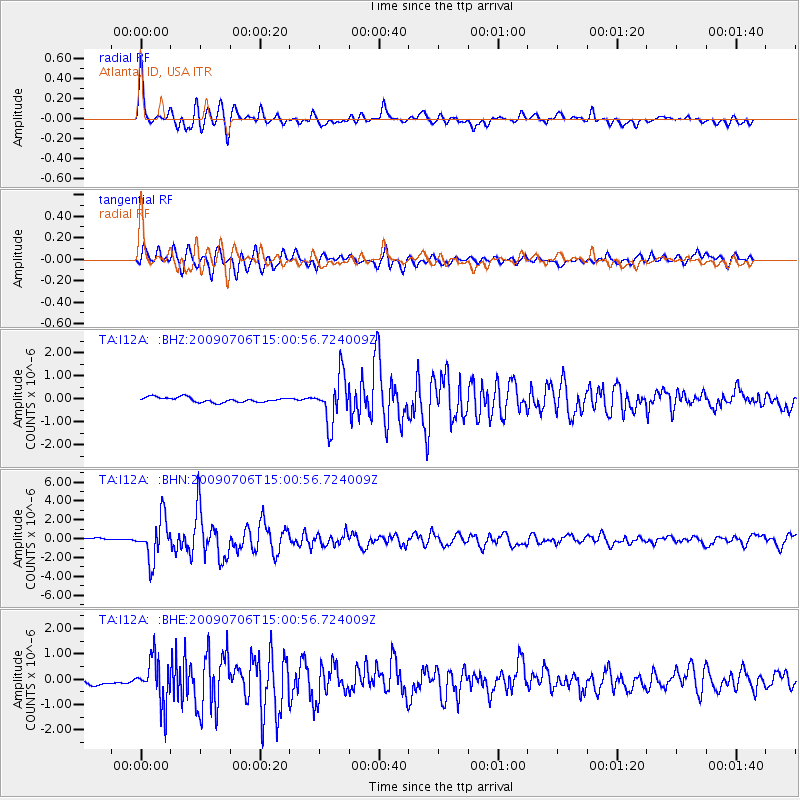
Earthquake location: Rat Islands, Aleutian Islands
Earthquake latitude/longitude: 50.4/177.0
Earthquake time(UTC): 2009/07/06 (187) 14:53:12 GMT
Earthquake Depth: 22 km
Earthquake Magnitude: 6.0 MB, 5.8 MS, 6.1 MW, 6.0 MW
Earthquake Catalog/Contributor: WHDF/NEIC
Network: TA USArray Transportable Network (new EarthScope stations)
Station: I12A Atlanta, ID, USA
Lat/Lon: 43.79 N/115.13 W
Elevation: 1849 m
Distance: 45.2 deg
Az: 70.972 deg
Baz: 303.4 deg
Ray Param: 0.07140046
Estimated Moho Depth: 29.75 km
Estimated Crust Vp/Vs: 1.62
Assumed Crust Vp: 6.291 km/s
Estimated Crust Vs: 3.896 km/s
Estimated Crust Poisson's Ratio: 0.19
Radial Match: 81.805374 %
Radial Bump: 400
Transverse Match: 78.69288 %
Transverse Bump: 400
SOD ConfigId: 2648
Insert Time: 2010-03-06 03:28:19.314 +0000
GWidth: 2.5
Max Bumps: 400
Tol: 0.001

Signal To Noise

ChannelStoNSTALTA
TA:I12A: :BHN:20090706T15:00:56.724009Z20.4467682.2062084E-61.0790011E-7
TA:I12A: :BHE:20090706T15:00:56.724009Z10.1232158.92063E-78.812053E-8
TA:I12A: :BHZ:20090706T15:00:56.724009Z9.6442561.0223655E-61.0600772E-7
Arrivals
Ps3.1 SECOND
PpPs12 SECOND
PsPs/PpSs15 SECOND