You are here: Home > Network List > TA - USArray Transportable Network (new EarthScope stations) Stations List
> Station I12A Atlanta, ID, USA > Earthquake Result Viewer
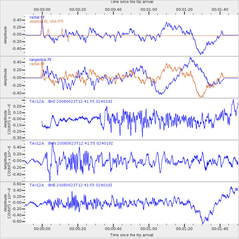
I12A Atlanta, ID, USA - Earthquake Result Viewer
*The percent match for this event was below the threshold and hence no stack was calculated.
| Earthquake location: |
Kuril Islands |
| Earthquake latitude/longitude: |
46.5/153.3 |
| Earthquake time(UTC): |
2008/06/23 (175) 12:32:12 GMT |
| Earthquake Depth: |
10 km |
| Earthquake Magnitude: |
5.6 MB, 5.2 MS, 5.6 MW, 5.6 MW |
| Earthquake Catalog/Contributor: |
WHDF/NEIC |
|
| Network: |
TA USArray Transportable Network (new EarthScope stations) |
| Station: |
I12A Atlanta, ID, USA |
| Lat/Lon: |
43.79 N/115.13 W |
| Elevation: |
1849 m |
|
| Distance: |
61.0 deg |
| Az: |
55.841 deg |
| Baz: |
307.85 deg |
| Ray Param: |
$rayparam |
*The percent match for this event was below the threshold and hence was not used in the summary stack. |
|
| Radial Match: |
25.23535 % |
| Radial Bump: |
400 |
| Transverse Match: |
20.467564 % |
| Transverse Bump: |
400 |
| SOD ConfigId: |
2504 |
| Insert Time: |
2010-03-06 03:29:06.894 +0000 |
| GWidth: |
2.5 |
| Max Bumps: |
400 |
| Tol: |
0.001 |
|
Signal To Noise
| Channel | StoN | STA | LTA |
| TA:I12A: :BHN:20080623T12:41:55.024019Z | 3.838002 | 2.2203594E-7 | 5.7851963E-8 |
| TA:I12A: :BHE:20080623T12:41:55.024019Z | 0.6674108 | 5.4573086E-8 | 8.176836E-8 |
| TA:I12A: :BHZ:20080623T12:41:55.024019Z | 1.3227674 | 7.1800365E-8 | 5.4280413E-8 |
| Arrivals |
| Ps | |
| PpPs | |
| PsPs/PpSs | |


