You are here: Home > Network List > TA - USArray Transportable Network (new EarthScope stations) Stations List
> Station R33M Jennings River, BC, CAN > Earthquake Result Viewer
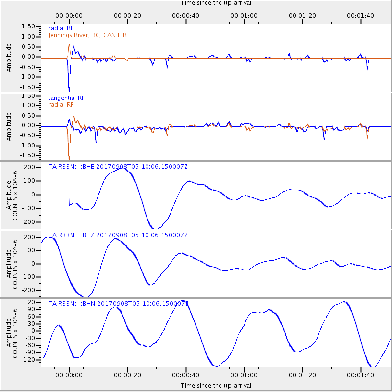
R33M Jennings River, BC, CAN - Earthquake Result Viewer
*The percent match for this event was below the threshold and hence no stack was calculated.
| Earthquake location: |
Near Coast Of Oaxaca, Mexico |
| Earthquake latitude/longitude: |
15.2/-94.3 |
| Earthquake time(UTC): |
2017/09/08 (251) 05:01:33 GMT |
| Earthquake Depth: |
36 km |
| Earthquake Magnitude: |
5.7 mb |
| Earthquake Catalog/Contributor: |
NEIC PDE/us |
|
| Network: |
TA USArray Transportable Network (new EarthScope stations) |
| Station: |
R33M Jennings River, BC, CAN |
| Lat/Lon: |
59.39 N/130.97 W |
| Elevation: |
1437 m |
|
| Distance: |
51.7 deg |
| Az: |
337.076 deg |
| Baz: |
132.687 deg |
| Ray Param: |
$rayparam |
*The percent match for this event was below the threshold and hence was not used in the summary stack. |
|
| Radial Match: |
66.42826 % |
| Radial Bump: |
400 |
| Transverse Match: |
71.46543 % |
| Transverse Bump: |
400 |
| SOD ConfigId: |
13570011 |
| Insert Time: |
2019-04-28 17:35:04.528 +0000 |
| GWidth: |
2.5 |
| Max Bumps: |
400 |
| Tol: |
0.001 |
|
Signal To Noise
| Channel | StoN | STA | LTA |
| TA:R33M: :BHZ:20170908T05:10:06.150007Z | 2.411749 | 2.1499964E-4 | 8.914677E-5 |
| TA:R33M: :BHN:20170908T05:10:06.150007Z | 0.714754 | 1.0499911E-4 | 1.4690244E-4 |
| TA:R33M: :BHE:20170908T05:10:06.150007Z | 2.291643 | 2.6150365E-4 | 1.1411186E-4 |
| Arrivals |
| Ps | |
| PpPs | |
| PsPs/PpSs | |


