You are here: Home > Network List > TA - USArray Transportable Network (new EarthScope stations) Stations List
> Station I12A Atlanta, ID, USA > Earthquake Result Viewer
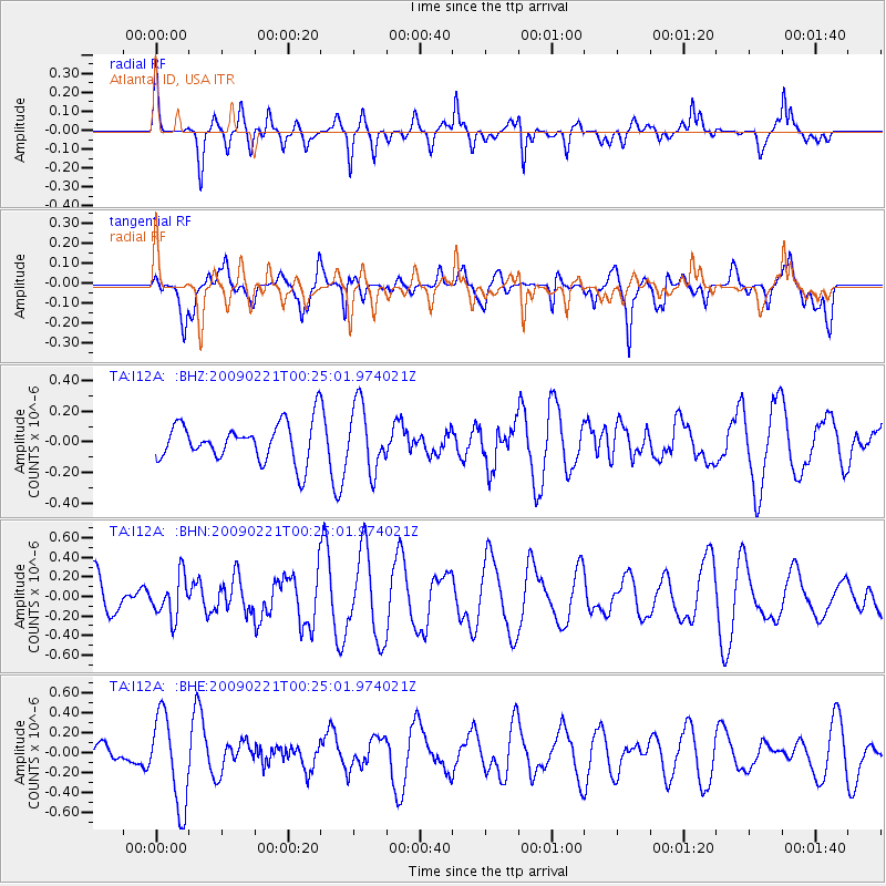
I12A Atlanta, ID, USA - Earthquake Result Viewer
*The percent match for this event was below the threshold and hence no stack was calculated.
| Earthquake location: |
Ryukyu Islands, Japan |
| Earthquake latitude/longitude: |
28.9/130.9 |
| Earthquake time(UTC): |
2009/02/21 (052) 00:12:56 GMT |
| Earthquake Depth: |
24 km |
| Earthquake Magnitude: |
5.6 MB, 5.0 MS, 5.5 MW, 5.5 MW |
| Earthquake Catalog/Contributor: |
WHDF/NEIC |
|
| Network: |
TA USArray Transportable Network (new EarthScope stations) |
| Station: |
I12A Atlanta, ID, USA |
| Lat/Lon: |
43.79 N/115.13 W |
| Elevation: |
1849 m |
|
| Distance: |
85.8 deg |
| Az: |
41.551 deg |
| Baz: |
306.55 deg |
| Ray Param: |
$rayparam |
*The percent match for this event was below the threshold and hence was not used in the summary stack. |
|
| Radial Match: |
71.53 % |
| Radial Bump: |
400 |
| Transverse Match: |
43.705807 % |
| Transverse Bump: |
400 |
| SOD ConfigId: |
2658 |
| Insert Time: |
2010-03-06 03:30:11.164 +0000 |
| GWidth: |
2.5 |
| Max Bumps: |
400 |
| Tol: |
0.001 |
|
Signal To Noise
| Channel | StoN | STA | LTA |
| TA:I12A: :BHN:20090221T00:25:01.974021Z | 0.75610995 | 2.0869489E-7 | 2.760113E-7 |
| TA:I12A: :BHE:20090221T00:25:01.974021Z | 2.7261074 | 4.5637685E-7 | 1.6740971E-7 |
| TA:I12A: :BHZ:20090221T00:25:01.974021Z | 1.6889521 | 2.1150855E-7 | 1.2523064E-7 |
| Arrivals |
| Ps | |
| PpPs | |
| PsPs/PpSs | |


