You are here: Home > Network List > TA - USArray Transportable Network (new EarthScope stations) Stations List
> Station I12A Atlanta, ID, USA > Earthquake Result Viewer
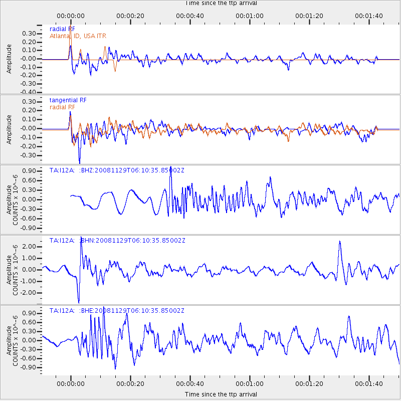
I12A Atlanta, ID, USA - Earthquake Result Viewer
*The percent match for this event was below the threshold and hence no stack was calculated.
| Earthquake location: |
Fiji Islands Region |
| Earthquake latitude/longitude: |
-18.7/-177.7 |
| Earthquake time(UTC): |
2008/11/29 (334) 05:59:16 GMT |
| Earthquake Depth: |
386 km |
| Earthquake Magnitude: |
5.7 MB, 6.0 MW, 5.9 MW |
| Earthquake Catalog/Contributor: |
WHDF/NEIC |
|
| Network: |
TA USArray Transportable Network (new EarthScope stations) |
| Station: |
I12A Atlanta, ID, USA |
| Lat/Lon: |
43.79 N/115.13 W |
| Elevation: |
1849 m |
|
| Distance: |
84.5 deg |
| Az: |
40.226 deg |
| Baz: |
237.706 deg |
| Ray Param: |
$rayparam |
*The percent match for this event was below the threshold and hence was not used in the summary stack. |
|
| Radial Match: |
49.914898 % |
| Radial Bump: |
400 |
| Transverse Match: |
72.64388 % |
| Transverse Bump: |
400 |
| SOD ConfigId: |
2658 |
| Insert Time: |
2010-03-06 03:30:13.503 +0000 |
| GWidth: |
2.5 |
| Max Bumps: |
400 |
| Tol: |
0.001 |
|
Signal To Noise
| Channel | StoN | STA | LTA |
| TA:I12A: :BHN:20081129T06:10:35.85002Z | 3.5396626 | 1.2526583E-6 | 3.53892E-7 |
| TA:I12A: :BHE:20081129T06:10:35.85002Z | 0.769314 | 1.6174504E-7 | 2.102458E-7 |
| TA:I12A: :BHZ:20081129T06:10:35.85002Z | 1.8893688 | 3.9542257E-7 | 2.0928819E-7 |
| Arrivals |
| Ps | |
| PpPs | |
| PsPs/PpSs | |


