You are here: Home > Network List > IW - Intermountain West Stations List
> Station MOOW Moose Ponds, Wyoming, USA > Earthquake Result Viewer
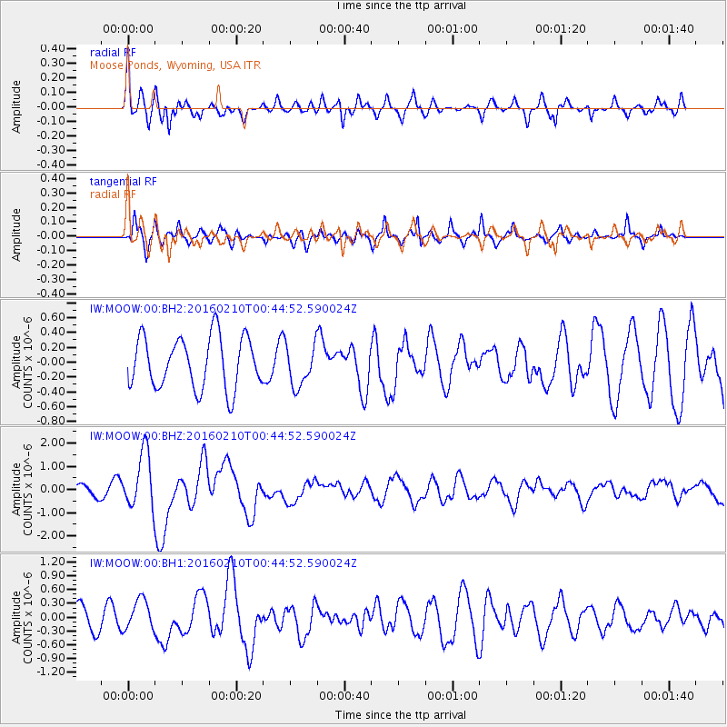
MOOW Moose Ponds, Wyoming, USA - Earthquake Result Viewer
*The percent match for this event was below the threshold and hence no stack was calculated.
| Earthquake location: |
Near Coast Of Central Chile |
| Earthquake latitude/longitude: |
-30.6/-71.6 |
| Earthquake time(UTC): |
2016/02/10 (041) 00:33:05 GMT |
| Earthquake Depth: |
32 km |
| Earthquake Magnitude: |
6.3 MWB |
| Earthquake Catalog/Contributor: |
NEIC PDE/NEIC COMCAT |
|
| Network: |
IW Intermountain West |
| Station: |
MOOW Moose Ponds, Wyoming, USA |
| Lat/Lon: |
43.75 N/110.74 W |
| Elevation: |
2128 m |
|
| Distance: |
82.2 deg |
| Az: |
332.514 deg |
| Baz: |
146.706 deg |
| Ray Param: |
$rayparam |
*The percent match for this event was below the threshold and hence was not used in the summary stack. |
|
| Radial Match: |
69.583 % |
| Radial Bump: |
400 |
| Transverse Match: |
65.83417 % |
| Transverse Bump: |
400 |
| SOD ConfigId: |
1427151 |
| Insert Time: |
2016-02-24 00:53:20.965 +0000 |
| GWidth: |
2.5 |
| Max Bumps: |
400 |
| Tol: |
0.001 |
|
Signal To Noise
| Channel | StoN | STA | LTA |
| IW:MOOW:00:BHZ:20160210T00:44:52.590024Z | 3.3417764 | 1.2343054E-6 | 3.6935606E-7 |
| IW:MOOW:00:BH1:20160210T00:44:52.590024Z | 1.2235184 | 3.394473E-7 | 2.774354E-7 |
| IW:MOOW:00:BH2:20160210T00:44:52.590024Z | 0.8039392 | 2.7892975E-7 | 3.4695378E-7 |
| Arrivals |
| Ps | |
| PpPs | |
| PsPs/PpSs | |


