You are here: Home > Network List > TA - USArray Transportable Network (new EarthScope stations) Stations List
> Station I12A Atlanta, ID, USA > Earthquake Result Viewer
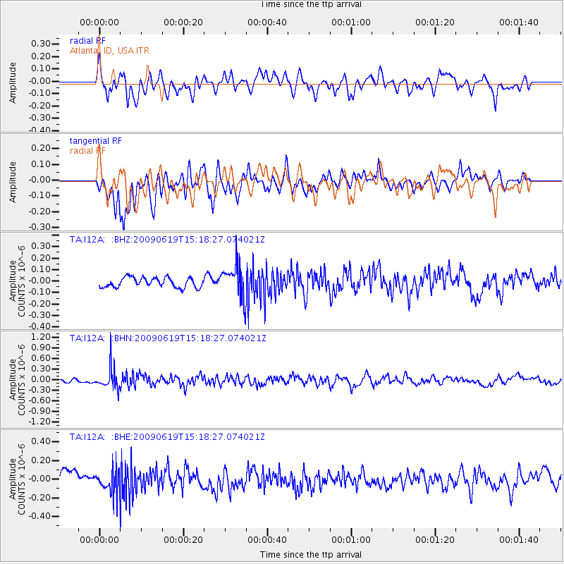
I12A Atlanta, ID, USA - Earthquake Result Viewer
*The percent match for this event was below the threshold and hence no stack was calculated.
| Earthquake location: |
Mariana Islands |
| Earthquake latitude/longitude: |
14.1/145.2 |
| Earthquake time(UTC): |
2009/06/19 (170) 15:06:24 GMT |
| Earthquake Depth: |
114 km |
| Earthquake Magnitude: |
5.5 MB, 5.5 MW |
| Earthquake Catalog/Contributor: |
WHDF/NEIC |
|
| Network: |
TA USArray Transportable Network (new EarthScope stations) |
| Station: |
I12A Atlanta, ID, USA |
| Lat/Lon: |
43.79 N/115.13 W |
| Elevation: |
1849 m |
|
| Distance: |
87.2 deg |
| Az: |
45.617 deg |
| Baz: |
286.729 deg |
| Ray Param: |
$rayparam |
*The percent match for this event was below the threshold and hence was not used in the summary stack. |
|
| Radial Match: |
67.79801 % |
| Radial Bump: |
400 |
| Transverse Match: |
72.08647 % |
| Transverse Bump: |
400 |
| SOD ConfigId: |
2648 |
| Insert Time: |
2010-03-06 03:30:25.973 +0000 |
| GWidth: |
2.5 |
| Max Bumps: |
400 |
| Tol: |
0.001 |
|
Signal To Noise
| Channel | StoN | STA | LTA |
| TA:I12A: :BHN:20090619T15:18:27.074021Z | 3.3814006 | 2.9997145E-7 | 8.871219E-8 |
| TA:I12A: :BHE:20090619T15:18:27.074021Z | 1.1748726 | 1.2857764E-7 | 1.0943963E-7 |
| TA:I12A: :BHZ:20090619T15:18:27.074021Z | 3.4711504 | 1.4634708E-7 | 4.2160973E-8 |
| Arrivals |
| Ps | |
| PpPs | |
| PsPs/PpSs | |


