You are here: Home > Network List > TA - USArray Transportable Network (new EarthScope stations) Stations List
> Station G21K Allakaket, AK, USA > Earthquake Result Viewer
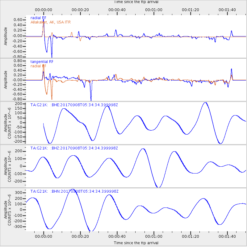
G21K Allakaket, AK, USA - Earthquake Result Viewer
*The percent match for this event was below the threshold and hence no stack was calculated.
| Earthquake location: |
Near Coast Of Oaxaca, Mexico |
| Earthquake latitude/longitude: |
15.2/-94.6 |
| Earthquake time(UTC): |
2017/09/08 (251) 05:24:36 GMT |
| Earthquake Depth: |
49 km |
| Earthquake Magnitude: |
5.2 mb |
| Earthquake Catalog/Contributor: |
NEIC PDE/us |
|
| Network: |
TA USArray Transportable Network (new EarthScope stations) |
| Station: |
G21K Allakaket, AK, USA |
| Lat/Lon: |
66.52 N/153.51 W |
| Elevation: |
446 m |
|
| Distance: |
64.0 deg |
| Az: |
337.55 deg |
| Baz: |
113.08 deg |
| Ray Param: |
$rayparam |
*The percent match for this event was below the threshold and hence was not used in the summary stack. |
|
| Radial Match: |
73.384766 % |
| Radial Bump: |
400 |
| Transverse Match: |
51.56239 % |
| Transverse Bump: |
400 |
| SOD ConfigId: |
13570011 |
| Insert Time: |
2019-04-28 17:44:02.363 +0000 |
| GWidth: |
2.5 |
| Max Bumps: |
400 |
| Tol: |
0.001 |
|
Signal To Noise
| Channel | StoN | STA | LTA |
| TA:G21K: :BHZ:20170908T05:34:34.399998Z | 0.9772632 | 9.725448E-5 | 9.951717E-5 |
| TA:G21K: :BHN:20170908T05:34:34.399998Z | 2.3630226 | 2.9917163E-4 | 1.2660549E-4 |
| TA:G21K: :BHE:20170908T05:34:34.399998Z | 1.0371354 | 1.1902168E-4 | 1.1476002E-4 |
| Arrivals |
| Ps | |
| PpPs | |
| PsPs/PpSs | |


