You are here: Home > Network List > TA - USArray Transportable Network (new EarthScope stations) Stations List
> Station I12A Atlanta, ID, USA > Earthquake Result Viewer
I12A Atlanta, ID, USA - Earthquake Result Viewer
*The percent match for this event was below the threshold and hence no stack was calculated.
| Earthquake location: |
Loyalty Islands |
| Earthquake latitude/longitude: |
-20.3/168.9 |
| Earthquake time(UTC): |
2008/04/10 (101) 01:10:02 GMT |
| Earthquake Depth: |
35 km |
| Earthquake Magnitude: |
5.5 MB, 5.5 MS, 5.8 MW |
| Earthquake Catalog/Contributor: |
WHDF/NEIC |
|
| Network: |
TA USArray Transportable Network (new EarthScope stations) |
| Station: |
I12A Atlanta, ID, USA |
| Lat/Lon: |
43.79 N/115.13 W |
| Elevation: |
1849 m |
|
| Distance: |
94.2 deg |
| Az: |
44.773 deg |
| Baz: |
245.884 deg |
| Ray Param: |
$rayparam |
*The percent match for this event was below the threshold and hence was not used in the summary stack. |
|
| Radial Match: |
71.36989 % |
| Radial Bump: |
400 |
| Transverse Match: |
69.62335 % |
| Transverse Bump: |
333 |
| SOD ConfigId: |
2504 |
| Insert Time: |
2010-03-06 03:30:39.892 +0000 |
| GWidth: |
2.5 |
| Max Bumps: |
400 |
| Tol: |
0.001 |
|
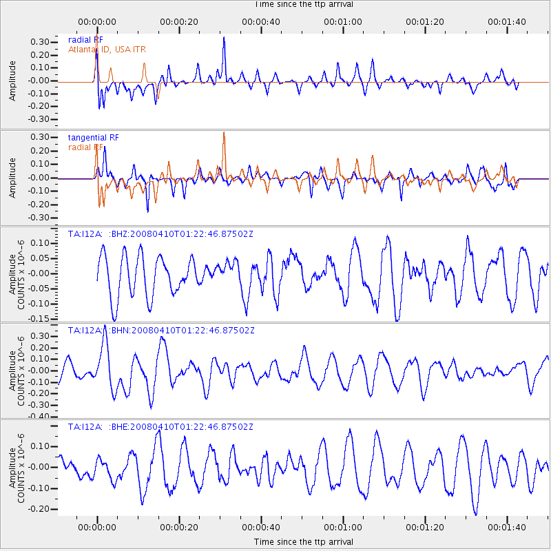
Signal To Noise
| Channel | StoN | STA | LTA |
| TA:I12A: :BHN:20080410T01:22:46.87502Z | 2.1056976 | 2.0130219E-7 | 9.5598814E-8 |
| TA:I12A: :BHE:20080410T01:22:46.87502Z | 0.8090283 | 4.8686488E-8 | 6.017896E-8 |
| TA:I12A: :BHZ:20080410T01:22:46.87502Z | 0.5888834 | 3.8296026E-8 | 6.503159E-8 |
| Arrivals |
| Ps | |
| PpPs | |
| PsPs/PpSs | |


