You are here: Home > Network List > TA - USArray Transportable Network (new EarthScope stations) Stations List
> Station R17K Ugashik Creek, AK, USA > Earthquake Result Viewer
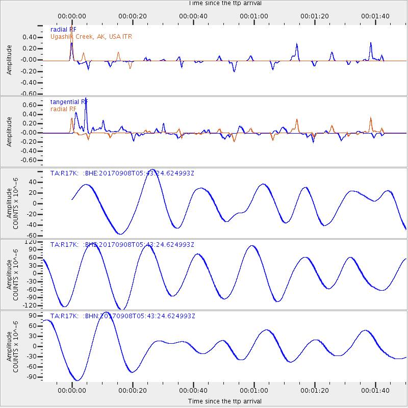
R17K Ugashik Creek, AK, USA - Earthquake Result Viewer
*The percent match for this event was below the threshold and hence no stack was calculated.
| Earthquake location: |
Near Coast Of Oaxaca, Mexico |
| Earthquake latitude/longitude: |
15.3/-94.4 |
| Earthquake time(UTC): |
2017/09/08 (251) 05:33:37 GMT |
| Earthquake Depth: |
46 km |
| Earthquake Magnitude: |
5.2 mb |
| Earthquake Catalog/Contributor: |
NEIC PDE/us |
|
| Network: |
TA USArray Transportable Network (new EarthScope stations) |
| Station: |
R17K Ugashik Creek, AK, USA |
| Lat/Lon: |
57.64 N/156.39 W |
| Elevation: |
273 m |
|
| Distance: |
62.3 deg |
| Az: |
327.577 deg |
| Baz: |
105.817 deg |
| Ray Param: |
$rayparam |
*The percent match for this event was below the threshold and hence was not used in the summary stack. |
|
| Radial Match: |
62.479465 % |
| Radial Bump: |
310 |
| Transverse Match: |
92.89119 % |
| Transverse Bump: |
400 |
| SOD ConfigId: |
13570011 |
| Insert Time: |
2019-04-28 17:48:29.388 +0000 |
| GWidth: |
2.5 |
| Max Bumps: |
400 |
| Tol: |
0.001 |
|
Signal To Noise
| Channel | StoN | STA | LTA |
| TA:R17K: :BHZ:20170908T05:43:24.624993Z | 1.5344778 | 6.565219E-5 | 4.278471E-5 |
| TA:R17K: :BHN:20170908T05:43:24.624993Z | 2.023495 | 9.327621E-5 | 4.609659E-5 |
| TA:R17K: :BHE:20170908T05:43:24.624993Z | 0.8697655 | 2.885675E-5 | 3.317762E-5 |
| Arrivals |
| Ps | |
| PpPs | |
| PsPs/PpSs | |


