You are here: Home > Network List > TA - USArray Transportable Network (new EarthScope stations) Stations List
> Station E18K Tukpahlearik Creek, AK, USA > Earthquake Result Viewer
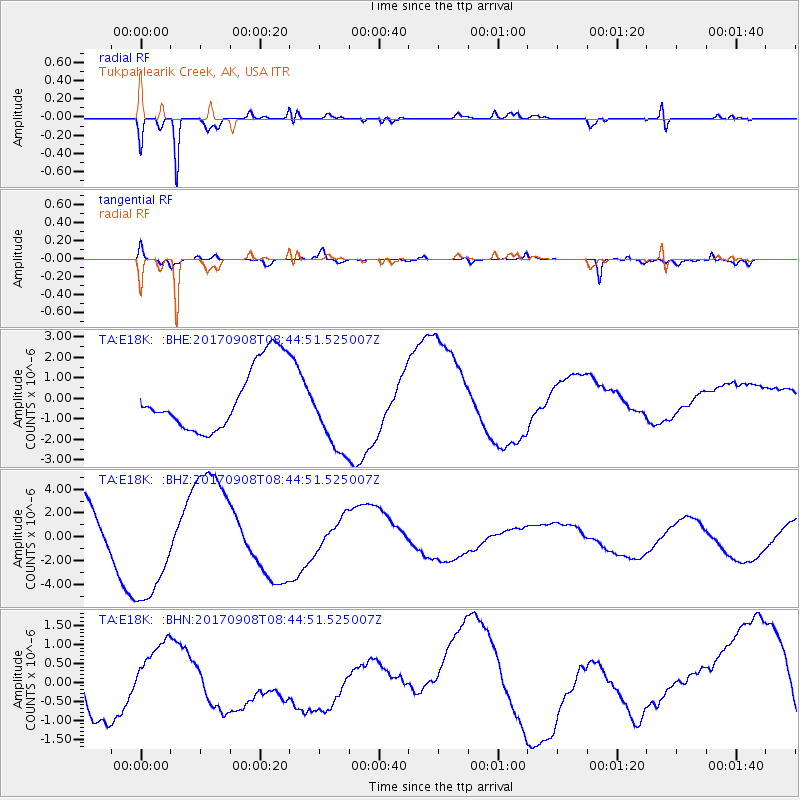
E18K Tukpahlearik Creek, AK, USA - Earthquake Result Viewer
*The percent match for this event was below the threshold and hence no stack was calculated.
| Earthquake location: |
Near Coast Of Oaxaca, Mexico |
| Earthquake latitude/longitude: |
15.2/-94.2 |
| Earthquake time(UTC): |
2017/09/08 (251) 08:34:34 GMT |
| Earthquake Depth: |
51 km |
| Earthquake Magnitude: |
5.3 mb |
| Earthquake Catalog/Contributor: |
NEIC PDE/us |
|
| Network: |
TA USArray Transportable Network (new EarthScope stations) |
| Station: |
E18K Tukpahlearik Creek, AK, USA |
| Lat/Lon: |
67.42 N/160.60 W |
| Elevation: |
297 m |
|
| Distance: |
67.1 deg |
| Az: |
337.399 deg |
| Baz: |
106.099 deg |
| Ray Param: |
$rayparam |
*The percent match for this event was below the threshold and hence was not used in the summary stack. |
|
| Radial Match: |
87.50498 % |
| Radial Bump: |
266 |
| Transverse Match: |
60.545444 % |
| Transverse Bump: |
278 |
| SOD ConfigId: |
13570011 |
| Insert Time: |
2019-04-28 17:52:26.038 +0000 |
| GWidth: |
2.5 |
| Max Bumps: |
400 |
| Tol: |
0.001 |
|
Signal To Noise
| Channel | StoN | STA | LTA |
| TA:E18K: :BHZ:20170908T08:44:51.525007Z | 2.0715952 | 4.7988437E-6 | 2.3164969E-6 |
| TA:E18K: :BHN:20170908T08:44:51.525007Z | 1.1337689 | 7.6071166E-7 | 6.7095834E-7 |
| TA:E18K: :BHE:20170908T08:44:51.525007Z | 1.2712109 | 2.019131E-6 | 1.5883525E-6 |
| Arrivals |
| Ps | |
| PpPs | |
| PsPs/PpSs | |


