You are here: Home > Network List > TA - USArray Transportable Network (new EarthScope stations) Stations List
> Station R33M Jennings River, BC, CAN > Earthquake Result Viewer
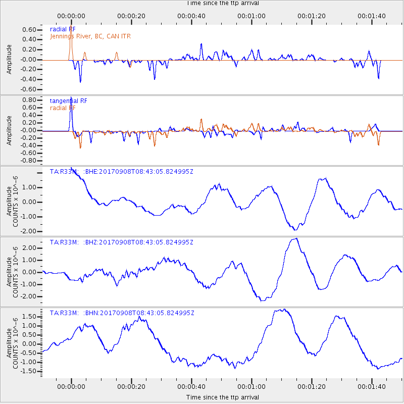
R33M Jennings River, BC, CAN - Earthquake Result Viewer
*The percent match for this event was below the threshold and hence no stack was calculated.
| Earthquake location: |
Near Coast Of Oaxaca, Mexico |
| Earthquake latitude/longitude: |
15.2/-94.2 |
| Earthquake time(UTC): |
2017/09/08 (251) 08:34:34 GMT |
| Earthquake Depth: |
51 km |
| Earthquake Magnitude: |
5.3 mb |
| Earthquake Catalog/Contributor: |
NEIC PDE/us |
|
| Network: |
TA USArray Transportable Network (new EarthScope stations) |
| Station: |
R33M Jennings River, BC, CAN |
| Lat/Lon: |
59.39 N/130.97 W |
| Elevation: |
1437 m |
|
| Distance: |
51.7 deg |
| Az: |
337.018 deg |
| Baz: |
132.55 deg |
| Ray Param: |
$rayparam |
*The percent match for this event was below the threshold and hence was not used in the summary stack. |
|
| Radial Match: |
55.11325 % |
| Radial Bump: |
305 |
| Transverse Match: |
73.16746 % |
| Transverse Bump: |
262 |
| SOD ConfigId: |
13570011 |
| Insert Time: |
2019-04-28 17:53:06.956 +0000 |
| GWidth: |
2.5 |
| Max Bumps: |
400 |
| Tol: |
0.001 |
|
Signal To Noise
| Channel | StoN | STA | LTA |
| TA:R33M: :BHZ:20170908T08:43:05.824995Z | 1.2046535 | 5.600142E-7 | 4.6487574E-7 |
| TA:R33M: :BHN:20170908T08:43:05.824995Z | 2.8994093 | 1.3859946E-6 | 4.7802655E-7 |
| TA:R33M: :BHE:20170908T08:43:05.824995Z | 1.257025 | 9.505112E-7 | 7.561594E-7 |
| Arrivals |
| Ps | |
| PpPs | |
| PsPs/PpSs | |


