You are here: Home > Network List > TA - USArray Transportable Network (new EarthScope stations) Stations List
> Station J20K Nowitna River, AK, USA > Earthquake Result Viewer
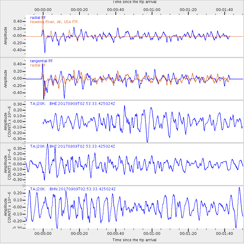
J20K Nowitna River, AK, USA - Earthquake Result Viewer
*The percent match for this event was below the threshold and hence no stack was calculated.
| Earthquake location: |
Near Coast Of Oaxaca, Mexico |
| Earthquake latitude/longitude: |
15.6/-94.8 |
| Earthquake time(UTC): |
2017/09/09 (252) 02:43:44 GMT |
| Earthquake Depth: |
58 km |
| Earthquake Magnitude: |
5.1 mb |
| Earthquake Catalog/Contributor: |
NEIC PDE/us |
|
| Network: |
TA USArray Transportable Network (new EarthScope stations) |
| Station: |
J20K Nowitna River, AK, USA |
| Lat/Lon: |
64.18 N/154.15 W |
| Elevation: |
314 m |
|
| Distance: |
62.9 deg |
| Az: |
334.952 deg |
| Baz: |
111.357 deg |
| Ray Param: |
$rayparam |
*The percent match for this event was below the threshold and hence was not used in the summary stack. |
|
| Radial Match: |
51.326706 % |
| Radial Bump: |
395 |
| Transverse Match: |
61.89751 % |
| Transverse Bump: |
400 |
| SOD ConfigId: |
13570011 |
| Insert Time: |
2019-04-28 17:57:36.501 +0000 |
| GWidth: |
2.5 |
| Max Bumps: |
400 |
| Tol: |
0.001 |
|
Signal To Noise
| Channel | StoN | STA | LTA |
| TA:J20K: :BHZ:20170909T02:53:33.425024Z | 3.01055 | 1.8990565E-7 | 6.308005E-8 |
| TA:J20K: :BHN:20170909T02:53:33.425024Z | 0.90245515 | 8.252715E-8 | 9.1447376E-8 |
| TA:J20K: :BHE:20170909T02:53:33.425024Z | 1.1222672 | 8.139758E-8 | 7.252958E-8 |
| Arrivals |
| Ps | |
| PpPs | |
| PsPs/PpSs | |


