You are here: Home > Network List > US - United States National Seismic Network Stations List
> Station CBKS Cedar Bluff, Kansas, USA > Earthquake Result Viewer
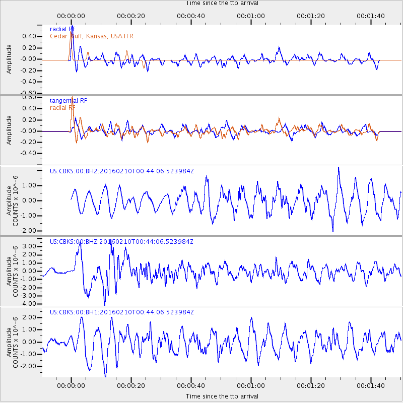
CBKS Cedar Bluff, Kansas, USA - Earthquake Result Viewer
*The percent match for this event was below the threshold and hence no stack was calculated.
| Earthquake location: |
Near Coast Of Central Chile |
| Earthquake latitude/longitude: |
-30.6/-71.6 |
| Earthquake time(UTC): |
2016/02/10 (041) 00:33:05 GMT |
| Earthquake Depth: |
32 km |
| Earthquake Magnitude: |
6.3 MWB |
| Earthquake Catalog/Contributor: |
NEIC PDE/NEIC COMCAT |
|
| Network: |
US United States National Seismic Network |
| Station: |
CBKS Cedar Bluff, Kansas, USA |
| Lat/Lon: |
38.81 N/99.74 W |
| Elevation: |
677 m |
|
| Distance: |
73.9 deg |
| Az: |
337.467 deg |
| Baz: |
154.988 deg |
| Ray Param: |
$rayparam |
*The percent match for this event was below the threshold and hence was not used in the summary stack. |
|
| Radial Match: |
57.856197 % |
| Radial Bump: |
400 |
| Transverse Match: |
74.83018 % |
| Transverse Bump: |
400 |
| SOD ConfigId: |
1427151 |
| Insert Time: |
2016-02-24 00:59:46.071 +0000 |
| GWidth: |
2.5 |
| Max Bumps: |
400 |
| Tol: |
0.001 |
|
Signal To Noise
| Channel | StoN | STA | LTA |
| US:CBKS:00:BHZ:20160210T00:44:06.523984Z | 6.1001334 | 1.8366472E-6 | 3.010831E-7 |
| US:CBKS:00:BH1:20160210T00:44:06.523984Z | 1.3860911 | 1.0008864E-6 | 7.220928E-7 |
| US:CBKS:00:BH2:20160210T00:44:06.523984Z | 0.76224774 | 4.2915715E-7 | 5.630153E-7 |
| Arrivals |
| Ps | |
| PpPs | |
| PsPs/PpSs | |


