You are here: Home > Network List > TA - USArray Transportable Network (new EarthScope stations) Stations List
> Station E18K Tukpahlearik Creek, AK, USA > Earthquake Result Viewer
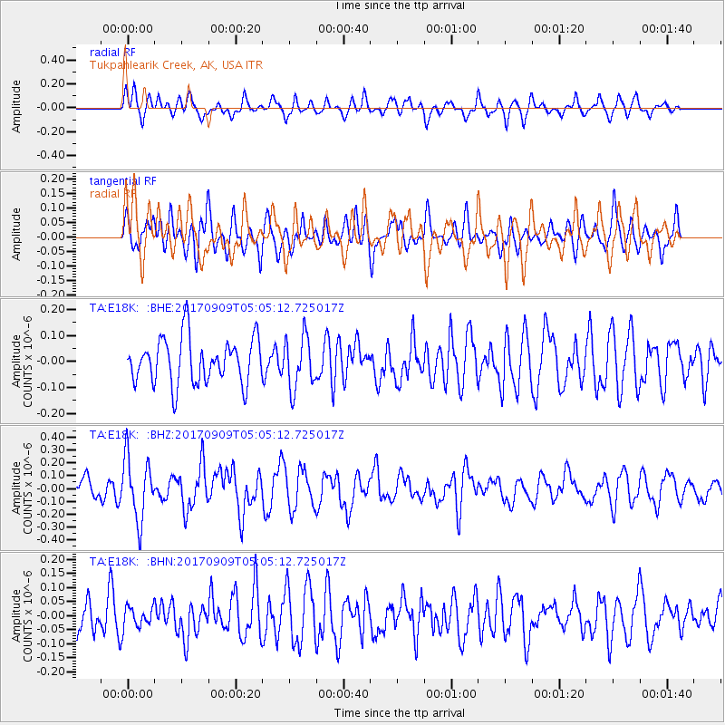
E18K Tukpahlearik Creek, AK, USA - Earthquake Result Viewer
*The percent match for this event was below the threshold and hence no stack was calculated.
| Earthquake location: |
Near Coast Of Chiapas, Mexico |
| Earthquake latitude/longitude: |
15.1/-93.9 |
| Earthquake time(UTC): |
2017/09/09 (252) 04:54:52 GMT |
| Earthquake Depth: |
29 km |
| Earthquake Magnitude: |
5.5 Mww |
| Earthquake Catalog/Contributor: |
NEIC PDE/us |
|
| Network: |
TA USArray Transportable Network (new EarthScope stations) |
| Station: |
E18K Tukpahlearik Creek, AK, USA |
| Lat/Lon: |
67.42 N/160.60 W |
| Elevation: |
297 m |
|
| Distance: |
67.3 deg |
| Az: |
337.392 deg |
| Baz: |
105.925 deg |
| Ray Param: |
$rayparam |
*The percent match for this event was below the threshold and hence was not used in the summary stack. |
|
| Radial Match: |
64.72686 % |
| Radial Bump: |
400 |
| Transverse Match: |
51.97848 % |
| Transverse Bump: |
400 |
| SOD ConfigId: |
13570011 |
| Insert Time: |
2019-04-28 18:02:17.807 +0000 |
| GWidth: |
2.5 |
| Max Bumps: |
400 |
| Tol: |
0.001 |
|
Signal To Noise
| Channel | StoN | STA | LTA |
| TA:E18K: :BHZ:20170909T05:05:12.725017Z | 2.637055 | 2.4408777E-7 | 9.256075E-8 |
| TA:E18K: :BHN:20170909T05:05:12.725017Z | 0.5542195 | 3.484753E-8 | 6.287677E-8 |
| TA:E18K: :BHE:20170909T05:05:12.725017Z | 1.1596683 | 1.0174746E-7 | 8.773841E-8 |
| Arrivals |
| Ps | |
| PpPs | |
| PsPs/PpSs | |


