You are here: Home > Network List > TA - USArray Transportable Network (new EarthScope stations) Stations List
> Station P17K Kvichak River, AK, USA > Earthquake Result Viewer
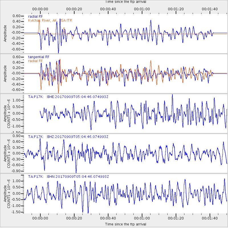
P17K Kvichak River, AK, USA - Earthquake Result Viewer
*The percent match for this event was below the threshold and hence no stack was calculated.
| Earthquake location: |
Near Coast Of Chiapas, Mexico |
| Earthquake latitude/longitude: |
15.1/-93.9 |
| Earthquake time(UTC): |
2017/09/09 (252) 04:54:52 GMT |
| Earthquake Depth: |
29 km |
| Earthquake Magnitude: |
5.5 Mww |
| Earthquake Catalog/Contributor: |
NEIC PDE/us |
|
| Network: |
TA USArray Transportable Network (new EarthScope stations) |
| Station: |
P17K Kvichak River, AK, USA |
| Lat/Lon: |
59.20 N/156.44 W |
| Elevation: |
91 m |
|
| Distance: |
63.2 deg |
| Az: |
329.231 deg |
| Baz: |
106.222 deg |
| Ray Param: |
$rayparam |
*The percent match for this event was below the threshold and hence was not used in the summary stack. |
|
| Radial Match: |
49.23124 % |
| Radial Bump: |
400 |
| Transverse Match: |
47.89307 % |
| Transverse Bump: |
400 |
| SOD ConfigId: |
13570011 |
| Insert Time: |
2019-04-28 18:03:06.146 +0000 |
| GWidth: |
2.5 |
| Max Bumps: |
400 |
| Tol: |
0.001 |
|
Signal To Noise
| Channel | StoN | STA | LTA |
| TA:P17K: :BHZ:20170909T05:04:46.074993Z | 2.8337286 | 3.8395726E-7 | 1.3549541E-7 |
| TA:P17K: :BHN:20170909T05:04:46.074993Z | 1.2732223 | 4.7983815E-7 | 3.7686908E-7 |
| TA:P17K: :BHE:20170909T05:04:46.074993Z | 1.9508432 | 5.362403E-7 | 2.748762E-7 |
| Arrivals |
| Ps | |
| PpPs | |
| PsPs/PpSs | |


