You are here: Home > Network List > AV - Alaska Volcano Observatory Stations List
> Station AMKA Regional Station, Amchitka Island, Alaska > Earthquake Result Viewer
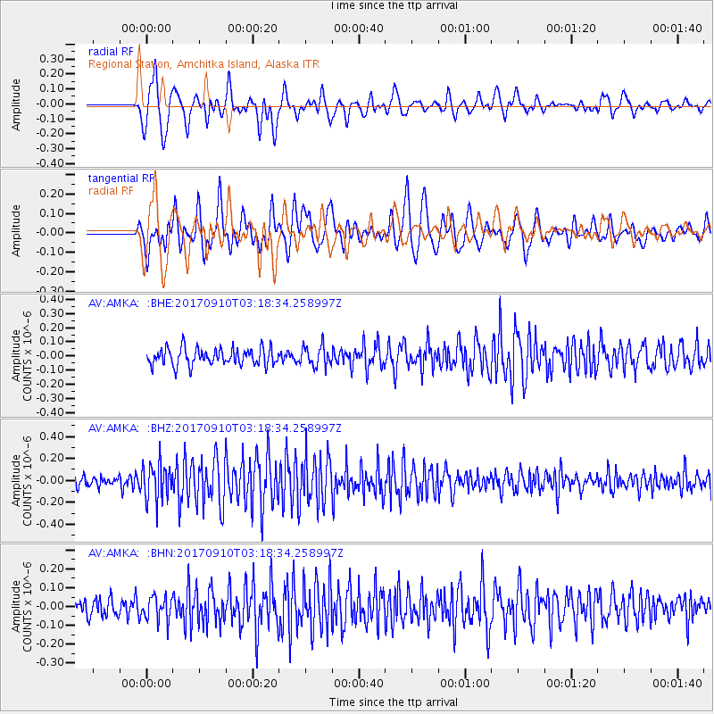
AMKA Regional Station, Amchitka Island, Alaska - Earthquake Result Viewer
*The percent match for this event was below the threshold and hence no stack was calculated.
| Earthquake location: |
Near Coast Of Oaxaca, Mexico |
| Earthquake latitude/longitude: |
15.5/-94.3 |
| Earthquake time(UTC): |
2017/09/10 (253) 03:07:26 GMT |
| Earthquake Depth: |
53 km |
| Earthquake Magnitude: |
5.7 Mww |
| Earthquake Catalog/Contributor: |
NEIC PDE/us |
|
| Network: |
AV Alaska Volcano Observatory |
| Station: |
AMKA Regional Station, Amchitka Island, Alaska |
| Lat/Lon: |
51.38 N/179.30 E |
| Elevation: |
116 m |
|
| Distance: |
75.8 deg |
| Az: |
319.824 deg |
| Baz: |
82.989 deg |
| Ray Param: |
$rayparam |
*The percent match for this event was below the threshold and hence was not used in the summary stack. |
|
| Radial Match: |
61.918766 % |
| Radial Bump: |
400 |
| Transverse Match: |
64.66871 % |
| Transverse Bump: |
400 |
| SOD ConfigId: |
13570011 |
| Insert Time: |
2019-04-28 18:04:53.312 +0000 |
| GWidth: |
2.5 |
| Max Bumps: |
400 |
| Tol: |
0.001 |
|
Signal To Noise
| Channel | StoN | STA | LTA |
| AV:AMKA: :BHZ:20170910T03:18:34.258997Z | 3.156048 | 1.6613177E-7 | 5.263918E-8 |
| AV:AMKA: :BHN:20170910T03:18:34.258997Z | 1.2823168 | 6.358681E-8 | 4.9587445E-8 |
| AV:AMKA: :BHE:20170910T03:18:34.258997Z | 1.1854312 | 6.85167E-8 | 5.7798967E-8 |
| Arrivals |
| Ps | |
| PpPs | |
| PsPs/PpSs | |


