You are here: Home > Network List > CI - Caltech Regional Seismic Network Stations List
> Station SMM Simmler, CA, USA > Earthquake Result Viewer
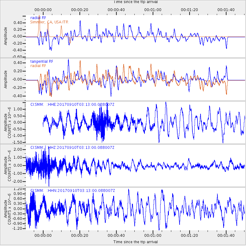
SMM Simmler, CA, USA - Earthquake Result Viewer
*The percent match for this event was below the threshold and hence no stack was calculated.
| Earthquake location: |
Near Coast Of Oaxaca, Mexico |
| Earthquake latitude/longitude: |
15.5/-94.3 |
| Earthquake time(UTC): |
2017/09/10 (253) 03:07:26 GMT |
| Earthquake Depth: |
53 km |
| Earthquake Magnitude: |
5.7 Mww |
| Earthquake Catalog/Contributor: |
NEIC PDE/us |
|
| Network: |
CI Caltech Regional Seismic Network |
| Station: |
SMM Simmler, CA, USA |
| Lat/Lon: |
35.31 N/120.00 W |
| Elevation: |
599 m |
|
| Distance: |
30.3 deg |
| Az: |
315.435 deg |
| Baz: |
124.176 deg |
| Ray Param: |
$rayparam |
*The percent match for this event was below the threshold and hence was not used in the summary stack. |
|
| Radial Match: |
51.300426 % |
| Radial Bump: |
400 |
| Transverse Match: |
68.11224 % |
| Transverse Bump: |
400 |
| SOD ConfigId: |
13570011 |
| Insert Time: |
2019-04-28 18:05:36.768 +0000 |
| GWidth: |
2.5 |
| Max Bumps: |
400 |
| Tol: |
0.001 |
|
Signal To Noise
| Channel | StoN | STA | LTA |
| CI:SMM: :HHZ:20170910T03:13:00.088007Z | 2.0809824 | 1.1141386E-6 | 5.353907E-7 |
| CI:SMM: :HHN:20170910T03:13:00.088007Z | 0.8717457 | 3.854788E-7 | 4.421918E-7 |
| CI:SMM: :HHE:20170910T03:13:00.088007Z | 1.5946715 | 6.6073864E-7 | 4.143415E-7 |
| Arrivals |
| Ps | |
| PpPs | |
| PsPs/PpSs | |


