You are here: Home > Network List > TA - USArray Transportable Network (new EarthScope stations) Stations List
> Station E18K Tukpahlearik Creek, AK, USA > Earthquake Result Viewer
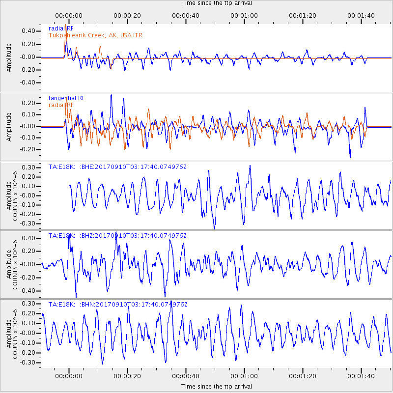
E18K Tukpahlearik Creek, AK, USA - Earthquake Result Viewer
*The percent match for this event was below the threshold and hence no stack was calculated.
| Earthquake location: |
Near Coast Of Oaxaca, Mexico |
| Earthquake latitude/longitude: |
15.5/-94.3 |
| Earthquake time(UTC): |
2017/09/10 (253) 03:07:26 GMT |
| Earthquake Depth: |
53 km |
| Earthquake Magnitude: |
5.7 Mww |
| Earthquake Catalog/Contributor: |
NEIC PDE/us |
|
| Network: |
TA USArray Transportable Network (new EarthScope stations) |
| Station: |
E18K Tukpahlearik Creek, AK, USA |
| Lat/Lon: |
67.42 N/160.60 W |
| Elevation: |
297 m |
|
| Distance: |
66.8 deg |
| Az: |
337.377 deg |
| Baz: |
106.161 deg |
| Ray Param: |
$rayparam |
*The percent match for this event was below the threshold and hence was not used in the summary stack. |
|
| Radial Match: |
61.186 % |
| Radial Bump: |
400 |
| Transverse Match: |
41.978737 % |
| Transverse Bump: |
391 |
| SOD ConfigId: |
13570011 |
| Insert Time: |
2019-04-28 18:07:59.780 +0000 |
| GWidth: |
2.5 |
| Max Bumps: |
400 |
| Tol: |
0.001 |
|
Signal To Noise
| Channel | StoN | STA | LTA |
| TA:E18K: :BHZ:20170910T03:17:40.074976Z | 3.6445196 | 2.3918153E-7 | 6.5627724E-8 |
| TA:E18K: :BHN:20170910T03:17:40.074976Z | 0.60285693 | 9.715654E-8 | 1.6116019E-7 |
| TA:E18K: :BHE:20170910T03:17:40.074976Z | 1.1118433 | 1.1240708E-7 | 1.0109975E-7 |
| Arrivals |
| Ps | |
| PpPs | |
| PsPs/PpSs | |


