You are here: Home > Network List > TA - USArray Transportable Network (new EarthScope stations) Stations List
> Station MDND Maddock, ND, USA > Earthquake Result Viewer
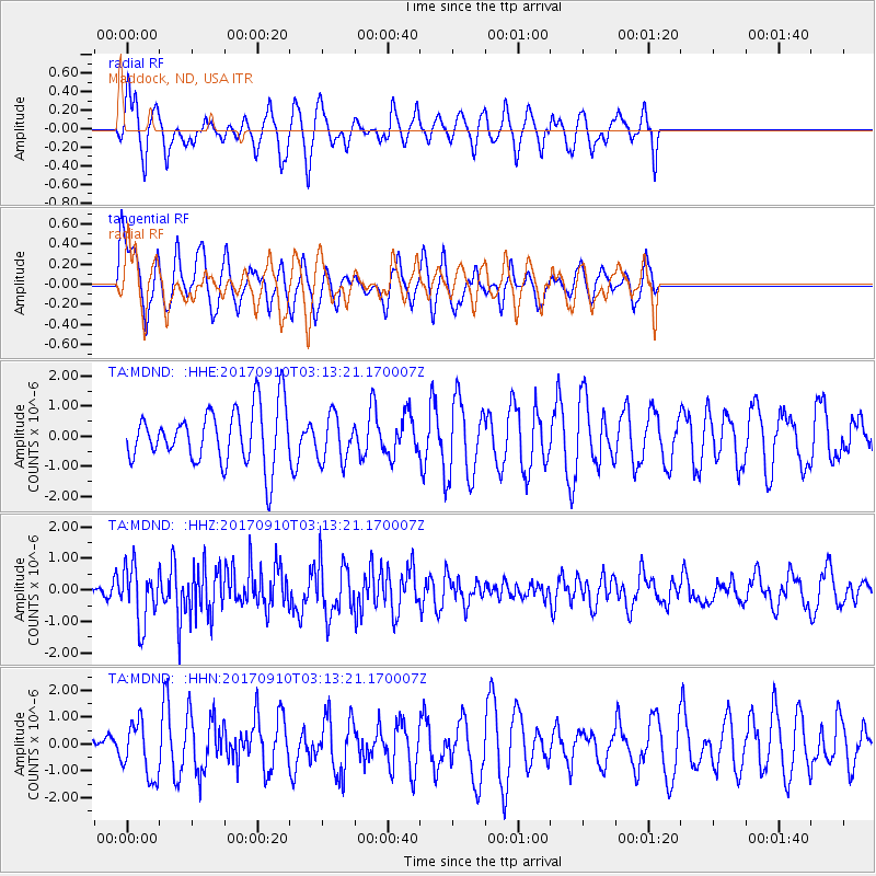
MDND Maddock, ND, USA - Earthquake Result Viewer
*The percent match for this event was below the threshold and hence no stack was calculated.
| Earthquake location: |
Near Coast Of Oaxaca, Mexico |
| Earthquake latitude/longitude: |
15.5/-94.3 |
| Earthquake time(UTC): |
2017/09/10 (253) 03:07:26 GMT |
| Earthquake Depth: |
53 km |
| Earthquake Magnitude: |
5.7 Mww |
| Earthquake Catalog/Contributor: |
NEIC PDE/us |
|
| Network: |
TA USArray Transportable Network (new EarthScope stations) |
| Station: |
MDND Maddock, ND, USA |
| Lat/Lon: |
47.85 N/99.60 W |
| Elevation: |
479 m |
|
| Distance: |
32.6 deg |
| Az: |
353.421 deg |
| Baz: |
170.561 deg |
| Ray Param: |
$rayparam |
*The percent match for this event was below the threshold and hence was not used in the summary stack. |
|
| Radial Match: |
64.8165 % |
| Radial Bump: |
400 |
| Transverse Match: |
55.4203 % |
| Transverse Bump: |
362 |
| SOD ConfigId: |
13570011 |
| Insert Time: |
2019-04-28 18:08:44.533 +0000 |
| GWidth: |
2.5 |
| Max Bumps: |
400 |
| Tol: |
0.001 |
|
Signal To Noise
| Channel | StoN | STA | LTA |
| TA:MDND: :HHZ:20170910T03:13:21.170007Z | 4.079827 | 8.8959445E-7 | 2.1804712E-7 |
| TA:MDND: :HHN:20170910T03:13:21.170007Z | 0.8664665 | 1.0298783E-6 | 1.1885957E-6 |
| TA:MDND: :HHE:20170910T03:13:21.170007Z | 0.77077436 | 7.206803E-7 | 9.3500813E-7 |
| Arrivals |
| Ps | |
| PpPs | |
| PsPs/PpSs | |


