You are here: Home > Network List > TA - USArray Transportable Network (new EarthScope stations) Stations List
> Station F20K Avaraart Lake, AK, USA > Earthquake Result Viewer
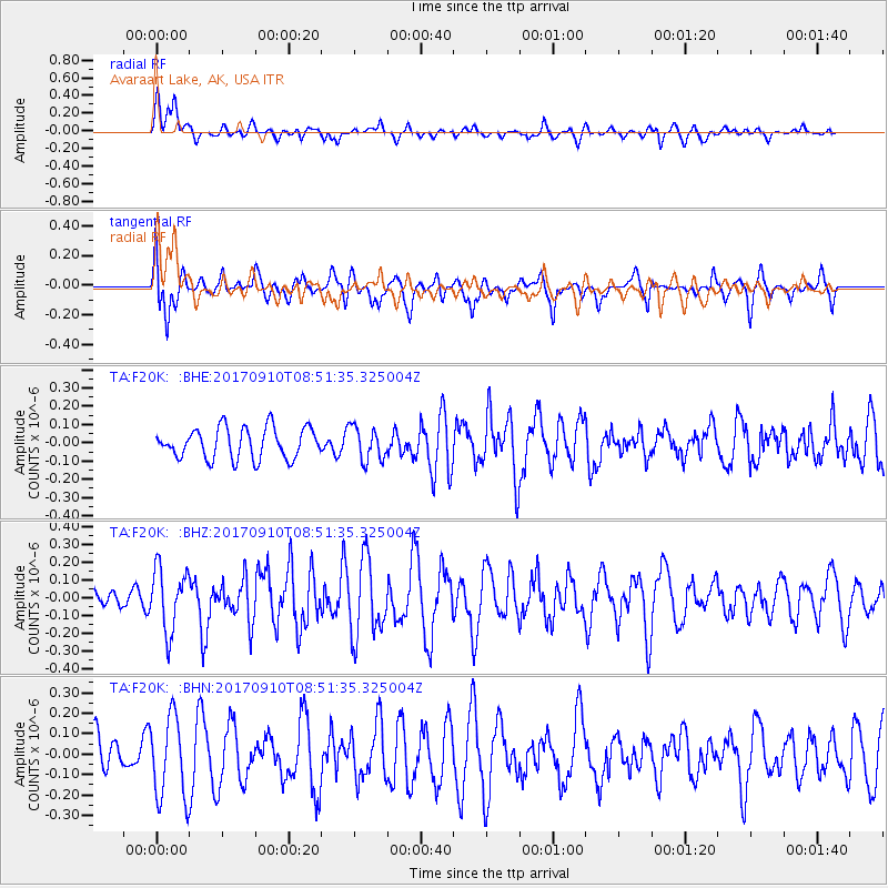
F20K Avaraart Lake, AK, USA - Earthquake Result Viewer
*The percent match for this event was below the threshold and hence no stack was calculated.
| Earthquake location: |
Hokkaido, Japan Region |
| Earthquake latitude/longitude: |
41.8/142.9 |
| Earthquake time(UTC): |
2017/09/10 (253) 08:44:24 GMT |
| Earthquake Depth: |
45 km |
| Earthquake Magnitude: |
5.5 Mww |
| Earthquake Catalog/Contributor: |
NEIC PDE/us |
|
| Network: |
TA USArray Transportable Network (new EarthScope stations) |
| Station: |
F20K Avaraart Lake, AK, USA |
| Lat/Lon: |
67.05 N/155.73 W |
| Elevation: |
136 m |
|
| Distance: |
41.3 deg |
| Az: |
31.431 deg |
| Baz: |
263.983 deg |
| Ray Param: |
$rayparam |
*The percent match for this event was below the threshold and hence was not used in the summary stack. |
|
| Radial Match: |
52.251606 % |
| Radial Bump: |
400 |
| Transverse Match: |
51.493664 % |
| Transverse Bump: |
400 |
| SOD ConfigId: |
13570011 |
| Insert Time: |
2019-04-28 18:16:16.988 +0000 |
| GWidth: |
2.5 |
| Max Bumps: |
400 |
| Tol: |
0.001 |
|
Signal To Noise
| Channel | StoN | STA | LTA |
| TA:F20K: :BHZ:20170910T08:51:35.325004Z | 3.0302098 | 1.7605979E-7 | 5.8101516E-8 |
| TA:F20K: :BHN:20170910T08:51:35.325004Z | 1.3247786 | 2.0136628E-7 | 1.5199994E-7 |
| TA:F20K: :BHE:20170910T08:51:35.325004Z | 1.094383 | 9.2259484E-8 | 8.430274E-8 |
| Arrivals |
| Ps | |
| PpPs | |
| PsPs/PpSs | |


