You are here: Home > Network List > TA - USArray Transportable Network (new EarthScope stations) Stations List
> Station G21K Allakaket, AK, USA > Earthquake Result Viewer
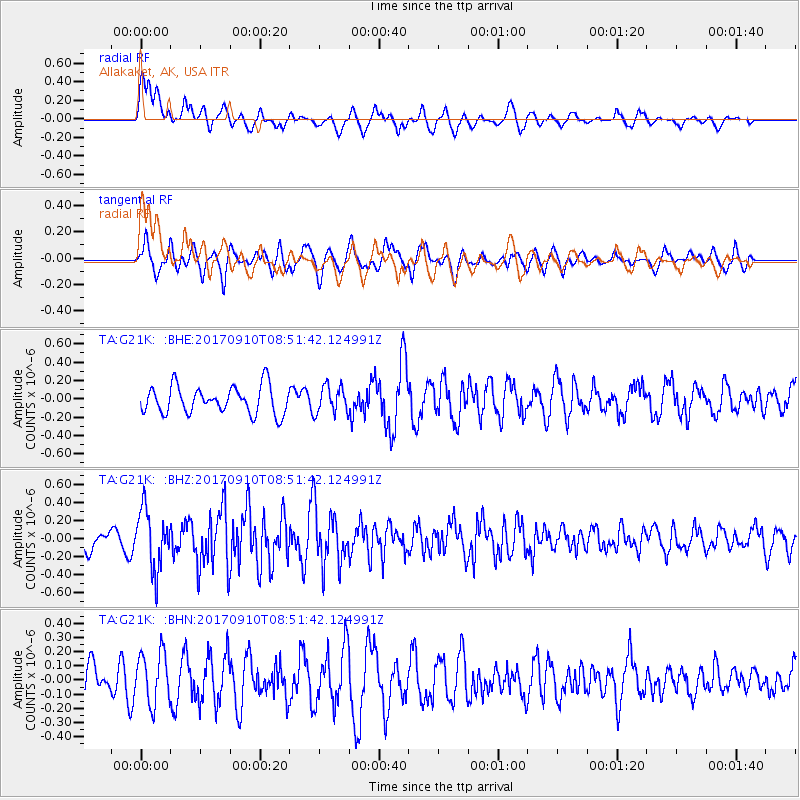
G21K Allakaket, AK, USA - Earthquake Result Viewer
*The percent match for this event was below the threshold and hence no stack was calculated.
| Earthquake location: |
Hokkaido, Japan Region |
| Earthquake latitude/longitude: |
41.8/142.9 |
| Earthquake time(UTC): |
2017/09/10 (253) 08:44:24 GMT |
| Earthquake Depth: |
45 km |
| Earthquake Magnitude: |
5.5 Mww |
| Earthquake Catalog/Contributor: |
NEIC PDE/us |
|
| Network: |
TA USArray Transportable Network (new EarthScope stations) |
| Station: |
G21K Allakaket, AK, USA |
| Lat/Lon: |
66.52 N/153.51 W |
| Elevation: |
446 m |
|
| Distance: |
42.1 deg |
| Az: |
32.34 deg |
| Baz: |
266.699 deg |
| Ray Param: |
$rayparam |
*The percent match for this event was below the threshold and hence was not used in the summary stack. |
|
| Radial Match: |
61.619934 % |
| Radial Bump: |
400 |
| Transverse Match: |
53.910458 % |
| Transverse Bump: |
400 |
| SOD ConfigId: |
13570011 |
| Insert Time: |
2019-04-28 18:16:20.628 +0000 |
| GWidth: |
2.5 |
| Max Bumps: |
400 |
| Tol: |
0.001 |
|
Signal To Noise
| Channel | StoN | STA | LTA |
| TA:G21K: :BHZ:20170910T08:51:42.124991Z | 3.3606172 | 3.213773E-7 | 9.563044E-8 |
| TA:G21K: :BHN:20170910T08:51:42.124991Z | 1.6460888 | 1.8199232E-7 | 1.1056044E-7 |
| TA:G21K: :BHE:20170910T08:51:42.124991Z | 0.98698926 | 1.4700422E-7 | 1.4894205E-7 |
| Arrivals |
| Ps | |
| PpPs | |
| PsPs/PpSs | |


