You are here: Home > Network List > TA - USArray Transportable Network (new EarthScope stations) Stations List
> Station K15K Wolf Creek Mountain, AK, USA > Earthquake Result Viewer
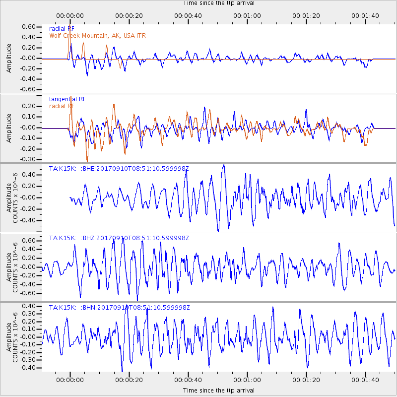
K15K Wolf Creek Mountain, AK, USA - Earthquake Result Viewer
*The percent match for this event was below the threshold and hence no stack was calculated.
| Earthquake location: |
Hokkaido, Japan Region |
| Earthquake latitude/longitude: |
41.8/142.9 |
| Earthquake time(UTC): |
2017/09/10 (253) 08:44:24 GMT |
| Earthquake Depth: |
45 km |
| Earthquake Magnitude: |
5.5 Mww |
| Earthquake Catalog/Contributor: |
NEIC PDE/us |
|
| Network: |
TA USArray Transportable Network (new EarthScope stations) |
| Station: |
K15K Wolf Creek Mountain, AK, USA |
| Lat/Lon: |
62.29 N/161.53 W |
| Elevation: |
346 m |
|
| Distance: |
38.3 deg |
| Az: |
38.436 deg |
| Baz: |
264.121 deg |
| Ray Param: |
$rayparam |
*The percent match for this event was below the threshold and hence was not used in the summary stack. |
|
| Radial Match: |
54.445408 % |
| Radial Bump: |
400 |
| Transverse Match: |
52.968098 % |
| Transverse Bump: |
367 |
| SOD ConfigId: |
13570011 |
| Insert Time: |
2019-04-28 18:16:37.771 +0000 |
| GWidth: |
2.5 |
| Max Bumps: |
400 |
| Tol: |
0.001 |
|
Signal To Noise
| Channel | StoN | STA | LTA |
| TA:K15K: :BHZ:20170910T08:51:10.599998Z | 1.9642513 | 2.8907206E-7 | 1.4716655E-7 |
| TA:K15K: :BHN:20170910T08:51:10.599998Z | 0.6789072 | 1.024837E-7 | 1.5095391E-7 |
| TA:K15K: :BHE:20170910T08:51:10.599998Z | 1.4001727 | 1.5941639E-7 | 1.138548E-7 |
| Arrivals |
| Ps | |
| PpPs | |
| PsPs/PpSs | |


