You are here: Home > Network List > TA - USArray Transportable Network (new EarthScope stations) Stations List
> Station WHTX Lake Whitney, Meridian, TX, USA > Earthquake Result Viewer
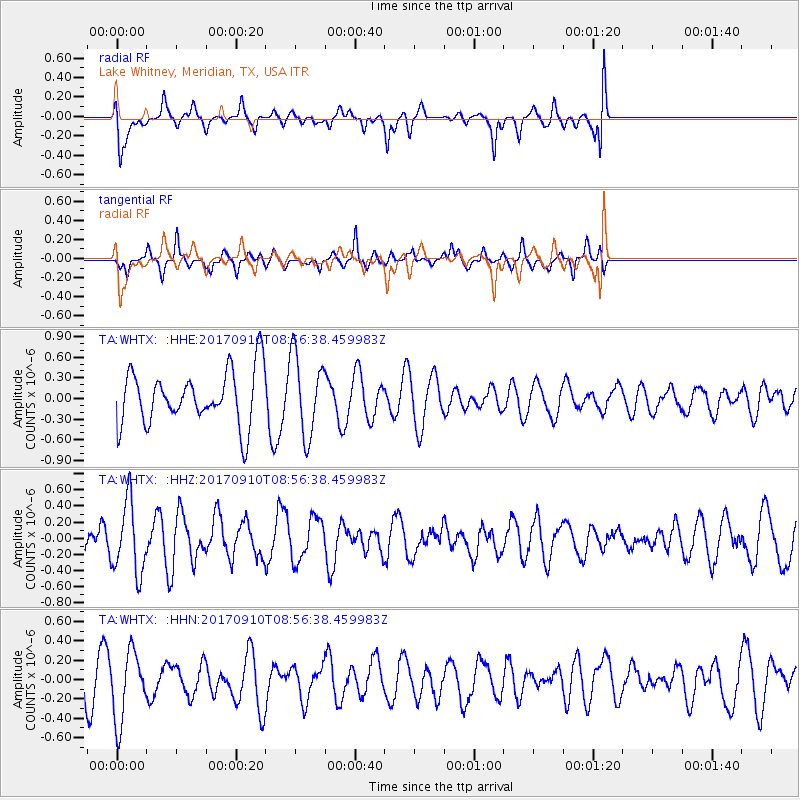
WHTX Lake Whitney, Meridian, TX, USA - Earthquake Result Viewer
*The percent match for this event was below the threshold and hence no stack was calculated.
| Earthquake location: |
Hokkaido, Japan Region |
| Earthquake latitude/longitude: |
41.8/142.9 |
| Earthquake time(UTC): |
2017/09/10 (253) 08:44:24 GMT |
| Earthquake Depth: |
45 km |
| Earthquake Magnitude: |
5.5 Mww |
| Earthquake Catalog/Contributor: |
NEIC PDE/us |
|
| Network: |
TA USArray Transportable Network (new EarthScope stations) |
| Station: |
WHTX Lake Whitney, Meridian, TX, USA |
| Lat/Lon: |
31.99 N/97.46 W |
| Elevation: |
190 m |
|
| Distance: |
88.0 deg |
| Az: |
47.64 deg |
| Baz: |
319.429 deg |
| Ray Param: |
$rayparam |
*The percent match for this event was below the threshold and hence was not used in the summary stack. |
|
| Radial Match: |
45.78898 % |
| Radial Bump: |
400 |
| Transverse Match: |
58.442 % |
| Transverse Bump: |
321 |
| SOD ConfigId: |
13570011 |
| Insert Time: |
2019-04-28 18:17:01.005 +0000 |
| GWidth: |
2.5 |
| Max Bumps: |
400 |
| Tol: |
0.001 |
|
Signal To Noise
| Channel | StoN | STA | LTA |
| TA:WHTX: :HHZ:20170910T08:56:38.459983Z | 1.9835831 | 4.4107725E-7 | 2.2236388E-7 |
| TA:WHTX: :HHN:20170910T08:56:38.459983Z | 1.0711945 | 3.6011855E-7 | 3.361841E-7 |
| TA:WHTX: :HHE:20170910T08:56:38.459983Z | 1.4924102 | 5.84537E-7 | 3.9167313E-7 |
| Arrivals |
| Ps | |
| PpPs | |
| PsPs/PpSs | |


