You are here: Home > Network List > CI - Caltech Regional Seismic Network Stations List
> Station MPP McPhearson Peak > Earthquake Result Viewer
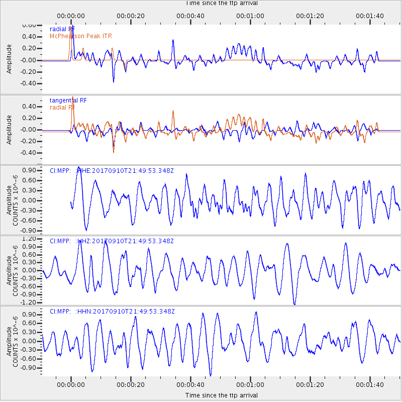
MPP McPhearson Peak - Earthquake Result Viewer
*The percent match for this event was below the threshold and hence no stack was calculated.
| Earthquake location: |
Reykjanes Ridge |
| Earthquake latitude/longitude: |
57.1/-33.7 |
| Earthquake time(UTC): |
2017/09/10 (253) 21:40:21 GMT |
| Earthquake Depth: |
10 km |
| Earthquake Magnitude: |
5.9 Mww |
| Earthquake Catalog/Contributor: |
NEIC PDE/us |
|
| Network: |
CI Caltech Regional Seismic Network |
| Station: |
MPP McPhearson Peak |
| Lat/Lon: |
34.89 N/119.81 W |
| Elevation: |
1739 m |
|
| Distance: |
59.5 deg |
| Az: |
287.848 deg |
| Baz: |
39.158 deg |
| Ray Param: |
$rayparam |
*The percent match for this event was below the threshold and hence was not used in the summary stack. |
|
| Radial Match: |
59.28674 % |
| Radial Bump: |
400 |
| Transverse Match: |
52.654728 % |
| Transverse Bump: |
400 |
| SOD ConfigId: |
13570011 |
| Insert Time: |
2019-04-28 18:21:02.044 +0000 |
| GWidth: |
2.5 |
| Max Bumps: |
400 |
| Tol: |
0.001 |
|
Signal To Noise
| Channel | StoN | STA | LTA |
| CI:MPP: :HHZ:20170910T21:49:53.348Z | 1.774145 | 5.6846477E-7 | 3.2041618E-7 |
| CI:MPP: :HHN:20170910T21:49:53.348Z | 1.3163965 | 3.791546E-7 | 2.8802464E-7 |
| CI:MPP: :HHE:20170910T21:49:53.348Z | 1.0019647 | 4.2293348E-7 | 4.2210416E-7 |
| Arrivals |
| Ps | |
| PpPs | |
| PsPs/PpSs | |


