You are here: Home > Network List > CI - Caltech Regional Seismic Network Stations List
> Station CHF Chilao Flat Rngr Sta, Altadena, CA, USA > Earthquake Result Viewer
CHF Chilao Flat Rngr Sta, Altadena, CA, USA - Earthquake Result Viewer

| Earthquake location: |
East Of Kuril Islands |
| Earthquake latitude/longitude: |
45.6/153.8 |
| Earthquake time(UTC): |
2007/01/13 (013) 09:18:31 GMT |
| Earthquake Depth: |
10 km |
| Earthquake Magnitude: |
5.8 MB |
| Earthquake Catalog/Contributor: |
WHDF/NEIC |
|
| Network: |
CI Caltech Regional Seismic Network |
| Station: |
CHF Chilao Flat Rngr Sta, Altadena, CA, USA |
| Lat/Lon: |
34.33 N/118.03 W |
| Elevation: |
1594 m |
|
| Distance: |
65.3 deg |
| Az: |
65.555 deg |
| Baz: |
309.395 deg |
| Ray Param: |
0.058357283 |
| Estimated Moho Depth: |
15.0 km |
| Estimated Crust Vp/Vs: |
1.99 |
| Assumed Crust Vp: |
6.1 km/s |
| Estimated Crust Vs: |
3.073 km/s |
| Estimated Crust Poisson's Ratio: |
0.33 |
|
| Radial Match: |
96.63178 % |
| Radial Bump: |
51 |
| Transverse Match: |
99.636635 % |
| Transverse Bump: |
32 |
| SOD ConfigId: |
2564 |
| Insert Time: |
2010-02-26 01:26:22.385 +0000 |
| GWidth: |
2.5 |
| Max Bumps: |
400 |
| Tol: |
0.001 |
|
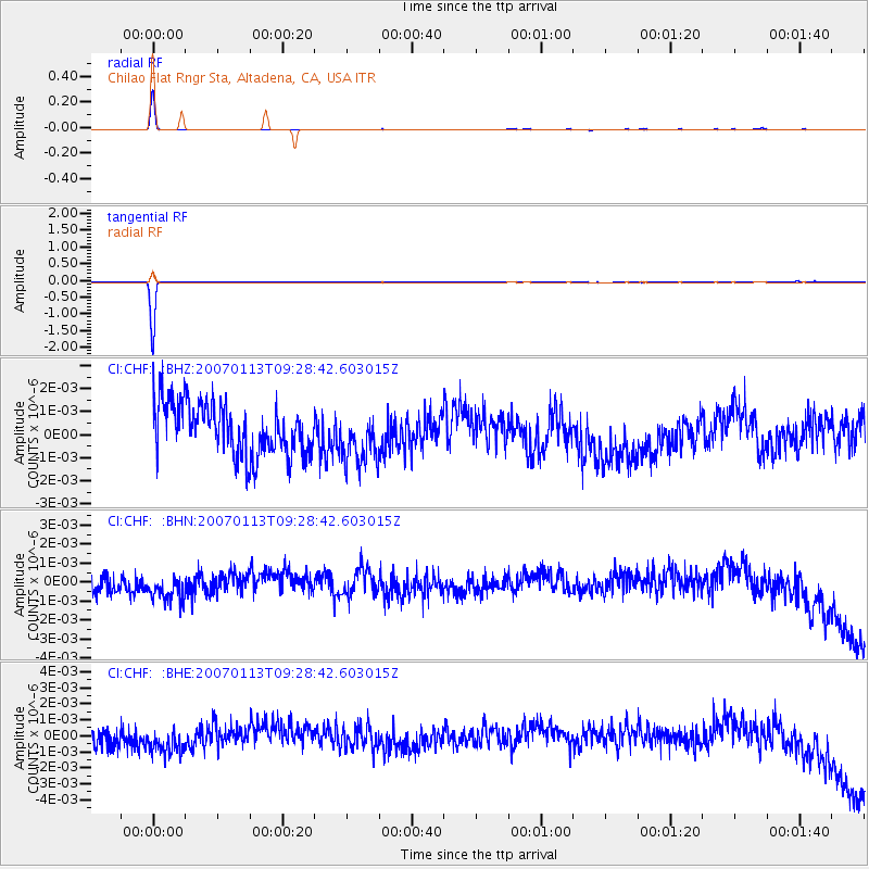
Signal To Noise
| Channel | StoN | STA | LTA |
| CI:CHF: :BHN:20070113T09:28:42.603015Z | 1.3529764 | 9.353649E-10 | 6.913387E-10 |
| CI:CHF: :BHE:20070113T09:28:42.603015Z | 1.104473 | 1.1503968E-9 | 1.0415797E-9 |
| CI:CHF: :BHZ:20070113T09:28:42.603015Z | 0.97736996 | 1.1042844E-9 | 1.1298531E-9 |
| Arrivals |
| Ps | 2.5 SECOND |
| PpPs | 7.1 SECOND |
| PsPs/PpSs | 9.6 SECOND |


