You are here: Home > Network List > TA - USArray Transportable Network (new EarthScope stations) Stations List
> Station 121A Cookes Peak, Deming, NM, USA > Earthquake Result Viewer
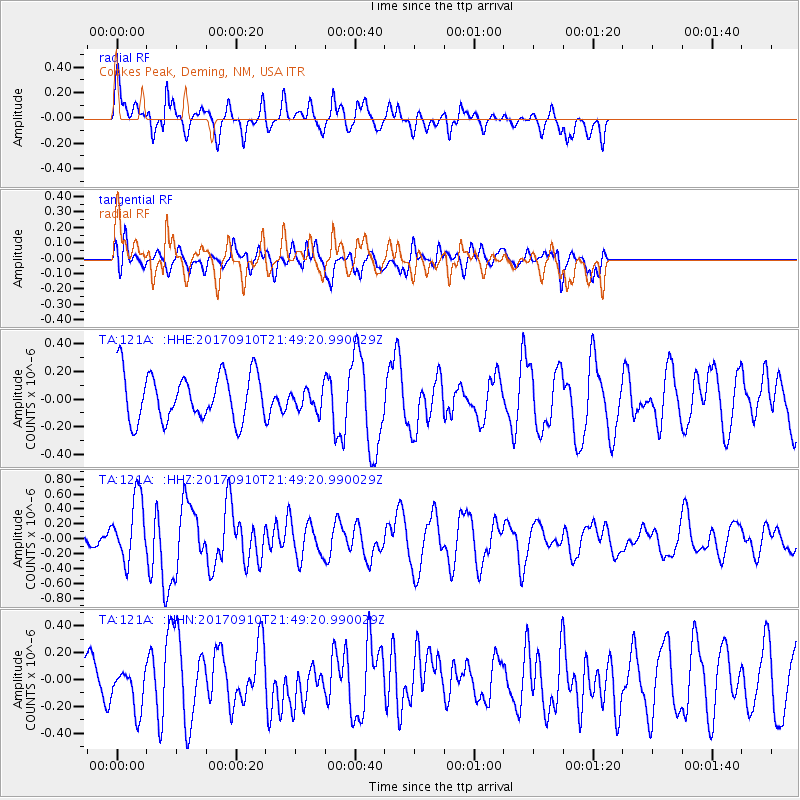
121A Cookes Peak, Deming, NM, USA - Earthquake Result Viewer
*The percent match for this event was below the threshold and hence no stack was calculated.
| Earthquake location: |
Reykjanes Ridge |
| Earthquake latitude/longitude: |
57.1/-33.7 |
| Earthquake time(UTC): |
2017/09/10 (253) 21:40:21 GMT |
| Earthquake Depth: |
10 km |
| Earthquake Magnitude: |
5.9 Mww |
| Earthquake Catalog/Contributor: |
NEIC PDE/us |
|
| Network: |
TA USArray Transportable Network (new EarthScope stations) |
| Station: |
121A Cookes Peak, Deming, NM, USA |
| Lat/Lon: |
32.53 N/107.79 W |
| Elevation: |
1652 m |
|
| Distance: |
54.9 deg |
| Az: |
276.878 deg |
| Baz: |
39.863 deg |
| Ray Param: |
$rayparam |
*The percent match for this event was below the threshold and hence was not used in the summary stack. |
|
| Radial Match: |
70.12209 % |
| Radial Bump: |
400 |
| Transverse Match: |
53.841038 % |
| Transverse Bump: |
400 |
| SOD ConfigId: |
13570011 |
| Insert Time: |
2019-04-28 18:26:20.212 +0000 |
| GWidth: |
2.5 |
| Max Bumps: |
400 |
| Tol: |
0.001 |
|
Signal To Noise
| Channel | StoN | STA | LTA |
| TA:121A: :HHZ:20170910T21:49:20.990029Z | 2.152518 | 4.2609733E-7 | 1.9795296E-7 |
| TA:121A: :HHN:20170910T21:49:20.990029Z | 1.2064605 | 1.5745033E-7 | 1.30506E-7 |
| TA:121A: :HHE:20170910T21:49:20.990029Z | 0.456032 | 7.7464385E-8 | 1.6986611E-7 |
| Arrivals |
| Ps | |
| PpPs | |
| PsPs/PpSs | |


