You are here: Home > Network List > TA - USArray Transportable Network (new EarthScope stations) Stations List
> Station R31K City Hall, Gustavus, AK, USA > Earthquake Result Viewer
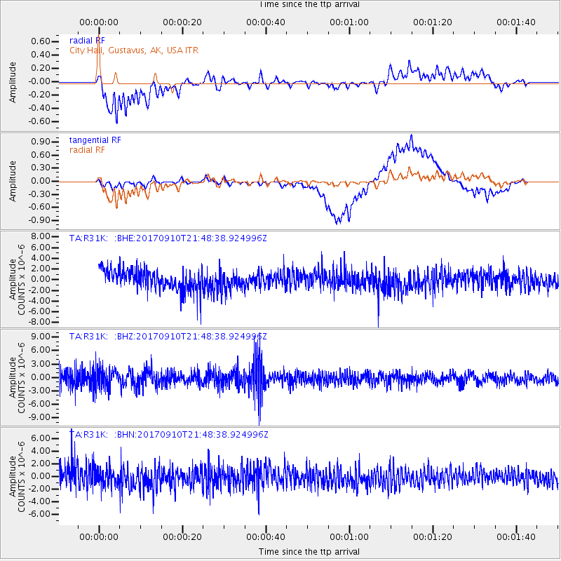
R31K City Hall, Gustavus, AK, USA - Earthquake Result Viewer
*The percent match for this event was below the threshold and hence no stack was calculated.
| Earthquake location: |
Reykjanes Ridge |
| Earthquake latitude/longitude: |
57.1/-33.7 |
| Earthquake time(UTC): |
2017/09/10 (253) 21:40:21 GMT |
| Earthquake Depth: |
10 km |
| Earthquake Magnitude: |
5.9 Mww |
| Earthquake Catalog/Contributor: |
NEIC PDE/us |
|
| Network: |
TA USArray Transportable Network (new EarthScope stations) |
| Station: |
R31K City Hall, Gustavus, AK, USA |
| Lat/Lon: |
58.41 N/135.74 W |
| Elevation: |
15 m |
|
| Distance: |
49.3 deg |
| Az: |
317.203 deg |
| Baz: |
44.744 deg |
| Ray Param: |
$rayparam |
*The percent match for this event was below the threshold and hence was not used in the summary stack. |
|
| Radial Match: |
28.540436 % |
| Radial Bump: |
400 |
| Transverse Match: |
51.640457 % |
| Transverse Bump: |
400 |
| SOD ConfigId: |
13570011 |
| Insert Time: |
2019-04-28 18:28:23.038 +0000 |
| GWidth: |
2.5 |
| Max Bumps: |
400 |
| Tol: |
0.001 |
|
Signal To Noise
| Channel | StoN | STA | LTA |
| TA:R31K: :BHZ:20170910T21:48:38.924996Z | 1.7106321 | 2.145569E-6 | 1.254255E-6 |
| TA:R31K: :BHN:20170910T21:48:38.924996Z | 0.7441748 | 1.190447E-6 | 1.5996875E-6 |
| TA:R31K: :BHE:20170910T21:48:38.924996Z | 0.88083166 | 1.6885214E-6 | 1.9169627E-6 |
| Arrivals |
| Ps | |
| PpPs | |
| PsPs/PpSs | |


