You are here: Home > Network List > IU - Global Seismograph Network (GSN - IRIS/USGS) Stations List
> Station PMG Port Moresby, New Guinea > Earthquake Result Viewer
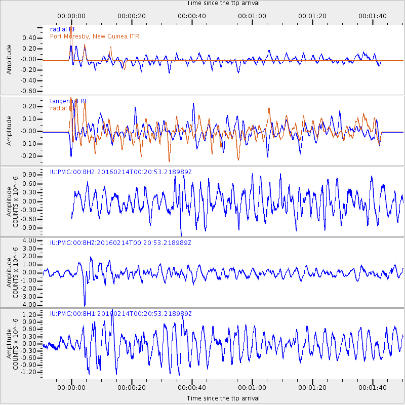
PMG Port Moresby, New Guinea - Earthquake Result Viewer
*The percent match for this event was below the threshold and hence no stack was calculated.
| Earthquake location: |
South Island, New Zealand |
| Earthquake latitude/longitude: |
-43.5/172.8 |
| Earthquake time(UTC): |
2016/02/14 (045) 00:13:43 GMT |
| Earthquake Depth: |
8.2 km |
| Earthquake Magnitude: |
5.8 MB |
| Earthquake Catalog/Contributor: |
NEIC PDE/NEIC COMCAT |
|
| Network: |
IU Global Seismograph Network (GSN - IRIS/USGS) |
| Station: |
PMG Port Moresby, New Guinea |
| Lat/Lon: |
9.40 S/147.16 E |
| Elevation: |
90 m |
|
| Distance: |
40.7 deg |
| Az: |
318.995 deg |
| Baz: |
151.063 deg |
| Ray Param: |
$rayparam |
*The percent match for this event was below the threshold and hence was not used in the summary stack. |
|
| Radial Match: |
69.01256 % |
| Radial Bump: |
400 |
| Transverse Match: |
61.365967 % |
| Transverse Bump: |
400 |
| SOD ConfigId: |
1427151 |
| Insert Time: |
2016-02-28 00:45:09.377 +0000 |
| GWidth: |
2.5 |
| Max Bumps: |
400 |
| Tol: |
0.001 |
|
Signal To Noise
| Channel | StoN | STA | LTA |
| IU:PMG:00:BHZ:20160214T00:20:53.218989Z | 4.064416 | 1.2764779E-6 | 3.1406185E-7 |
| IU:PMG:00:BH1:20160214T00:20:53.218989Z | 1.3875064 | 2.9625403E-7 | 2.1351543E-7 |
| IU:PMG:00:BH2:20160214T00:20:53.218989Z | 1.1582874 | 3.2246302E-7 | 2.7839639E-7 |
| Arrivals |
| Ps | |
| PpPs | |
| PsPs/PpSs | |


