You are here: Home > Network List > CI - Caltech Regional Seismic Network Stations List
> Station MPM Manuel Prospect Mine, California, USA > Earthquake Result Viewer
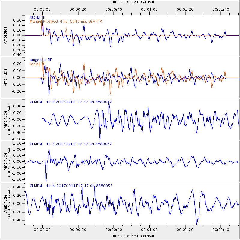
MPM Manuel Prospect Mine, California, USA - Earthquake Result Viewer
*The percent match for this event was below the threshold and hence no stack was calculated.
| Earthquake location: |
Volcano Islands, Japan Region |
| Earthquake latitude/longitude: |
24.0/142.3 |
| Earthquake time(UTC): |
2017/09/11 (254) 17:35:09 GMT |
| Earthquake Depth: |
35 km |
| Earthquake Magnitude: |
5.7 Mww |
| Earthquake Catalog/Contributor: |
NEIC PDE/us |
|
| Network: |
CI Caltech Regional Seismic Network |
| Station: |
MPM Manuel Prospect Mine, California, USA |
| Lat/Lon: |
36.06 N/117.49 W |
| Elevation: |
185 m |
|
| Distance: |
83.9 deg |
| Az: |
53.326 deg |
| Baz: |
295.1 deg |
| Ray Param: |
$rayparam |
*The percent match for this event was below the threshold and hence was not used in the summary stack. |
|
| Radial Match: |
66.96666 % |
| Radial Bump: |
400 |
| Transverse Match: |
48.678154 % |
| Transverse Bump: |
400 |
| SOD ConfigId: |
13570011 |
| Insert Time: |
2019-04-28 18:33:45.673 +0000 |
| GWidth: |
2.5 |
| Max Bumps: |
400 |
| Tol: |
0.001 |
|
Signal To Noise
| Channel | StoN | STA | LTA |
| CI:MPM: :HHZ:20170911T17:47:04.888005Z | 7.768217 | 6.3582064E-7 | 8.184898E-8 |
| CI:MPM: :HHN:20170911T17:47:04.888005Z | 0.82169384 | 1.1802742E-7 | 1.4363917E-7 |
| CI:MPM: :HHE:20170911T17:47:04.888005Z | 2.7766283 | 2.6673823E-7 | 9.606551E-8 |
| Arrivals |
| Ps | |
| PpPs | |
| PsPs/PpSs | |


