You are here: Home > Network List > CI - Caltech Regional Seismic Network Stations List
> Station SMM Simmler, CA, USA > Earthquake Result Viewer
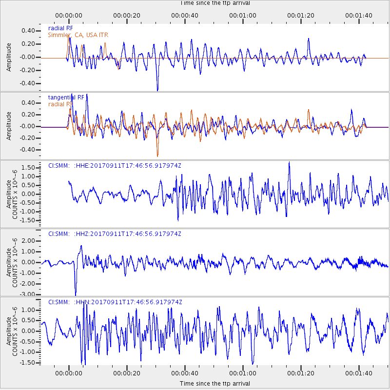
SMM Simmler, CA, USA - Earthquake Result Viewer
*The percent match for this event was below the threshold and hence no stack was calculated.
| Earthquake location: |
Volcano Islands, Japan Region |
| Earthquake latitude/longitude: |
24.0/142.3 |
| Earthquake time(UTC): |
2017/09/11 (254) 17:35:09 GMT |
| Earthquake Depth: |
35 km |
| Earthquake Magnitude: |
5.7 Mww |
| Earthquake Catalog/Contributor: |
NEIC PDE/us |
|
| Network: |
CI Caltech Regional Seismic Network |
| Station: |
SMM Simmler, CA, USA |
| Lat/Lon: |
35.31 N/120.00 W |
| Elevation: |
599 m |
|
| Distance: |
82.4 deg |
| Az: |
54.857 deg |
| Baz: |
293.826 deg |
| Ray Param: |
$rayparam |
*The percent match for this event was below the threshold and hence was not used in the summary stack. |
|
| Radial Match: |
51.945168 % |
| Radial Bump: |
400 |
| Transverse Match: |
65.09455 % |
| Transverse Bump: |
400 |
| SOD ConfigId: |
13570011 |
| Insert Time: |
2019-04-28 18:33:56.582 +0000 |
| GWidth: |
2.5 |
| Max Bumps: |
400 |
| Tol: |
0.001 |
|
Signal To Noise
| Channel | StoN | STA | LTA |
| CI:SMM: :HHZ:20170911T17:46:56.917974Z | 5.039454 | 1.0614707E-6 | 2.1063207E-7 |
| CI:SMM: :HHN:20170911T17:46:56.917974Z | 1.5611957 | 4.7900403E-7 | 3.068187E-7 |
| CI:SMM: :HHE:20170911T17:46:56.917974Z | 1.4303672 | 3.6599428E-7 | 2.5587434E-7 |
| Arrivals |
| Ps | |
| PpPs | |
| PsPs/PpSs | |


