You are here: Home > Network List > CN - Canadian National Seismograph Network Stations List
> Station INK INUVIK, NT > Earthquake Result Viewer
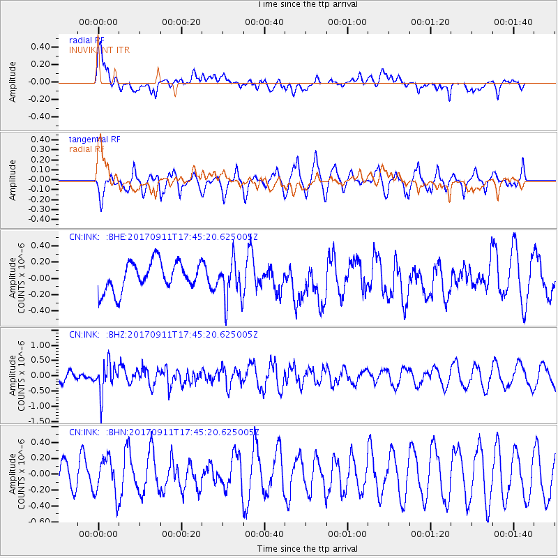
INK INUVIK, NT - Earthquake Result Viewer
*The percent match for this event was below the threshold and hence no stack was calculated.
| Earthquake location: |
Volcano Islands, Japan Region |
| Earthquake latitude/longitude: |
24.0/142.3 |
| Earthquake time(UTC): |
2017/09/11 (254) 17:35:09 GMT |
| Earthquake Depth: |
35 km |
| Earthquake Magnitude: |
5.7 Mww |
| Earthquake Catalog/Contributor: |
NEIC PDE/us |
|
| Network: |
CN Canadian National Seismograph Network |
| Station: |
INK INUVIK, NT |
| Lat/Lon: |
68.31 N/133.53 W |
| Elevation: |
44 m |
|
| Distance: |
65.8 deg |
| Az: |
23.916 deg |
| Baz: |
273.981 deg |
| Ray Param: |
$rayparam |
*The percent match for this event was below the threshold and hence was not used in the summary stack. |
|
| Radial Match: |
67.13749 % |
| Radial Bump: |
400 |
| Transverse Match: |
62.333717 % |
| Transverse Bump: |
353 |
| SOD ConfigId: |
13570011 |
| Insert Time: |
2019-04-28 18:34:11.790 +0000 |
| GWidth: |
2.5 |
| Max Bumps: |
400 |
| Tol: |
0.001 |
|
Signal To Noise
| Channel | StoN | STA | LTA |
| CN:INK: :BHZ:20170911T17:45:20.625005Z | 2.6618743 | 5.07918E-7 | 1.9081216E-7 |
| CN:INK: :BHN:20170911T17:45:20.625005Z | 0.79769576 | 2.402142E-7 | 3.0113512E-7 |
| CN:INK: :BHE:20170911T17:45:20.625005Z | 1.4669847 | 2.5784794E-7 | 1.7576728E-7 |
| Arrivals |
| Ps | |
| PpPs | |
| PsPs/PpSs | |


