You are here: Home > Network List > TA - USArray Transportable Network (new EarthScope stations) Stations List
> Station C16K Lisburne Hills, AK, USA > Earthquake Result Viewer
C16K Lisburne Hills, AK, USA - Earthquake Result Viewer
*The percent match for this event was below the threshold and hence no stack was calculated.
| Earthquake location: |
Volcano Islands, Japan Region |
| Earthquake latitude/longitude: |
24.0/142.3 |
| Earthquake time(UTC): |
2017/09/11 (254) 17:35:09 GMT |
| Earthquake Depth: |
35 km |
| Earthquake Magnitude: |
5.7 Mww |
| Earthquake Catalog/Contributor: |
NEIC PDE/us |
|
| Network: |
TA USArray Transportable Network (new EarthScope stations) |
| Station: |
C16K Lisburne Hills, AK, USA |
| Lat/Lon: |
68.27 N/165.34 W |
| Elevation: |
102 m |
|
| Distance: |
54.3 deg |
| Az: |
21.262 deg |
| Baz: |
243.013 deg |
| Ray Param: |
$rayparam |
*The percent match for this event was below the threshold and hence was not used in the summary stack. |
|
| Radial Match: |
65.10159 % |
| Radial Bump: |
400 |
| Transverse Match: |
59.70114 % |
| Transverse Bump: |
400 |
| SOD ConfigId: |
13570011 |
| Insert Time: |
2019-04-28 18:37:35.735 +0000 |
| GWidth: |
2.5 |
| Max Bumps: |
400 |
| Tol: |
0.001 |
|
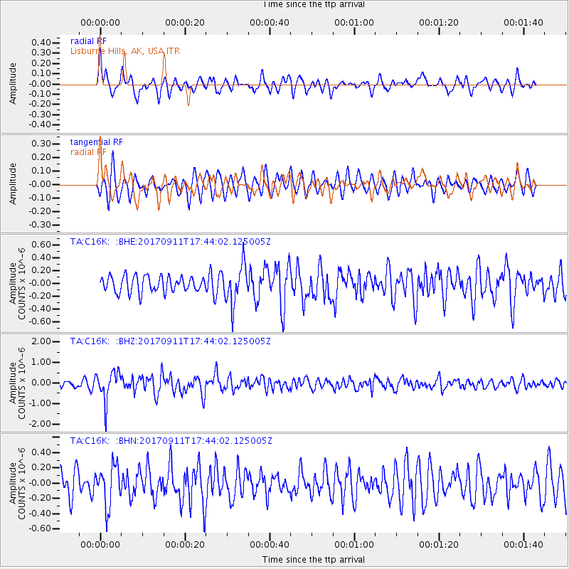
Signal To Noise
| Channel | StoN | STA | LTA |
| TA:C16K: :BHZ:20170911T17:44:02.125005Z | 5.3504786 | 7.019623E-7 | 1.3119616E-7 |
| TA:C16K: :BHN:20170911T17:44:02.125005Z | 1.8901514 | 2.6603087E-7 | 1.407458E-7 |
| TA:C16K: :BHE:20170911T17:44:02.125005Z | 2.5221035 | 3.018959E-7 | 1.1970005E-7 |
| Arrivals |
| Ps | |
| PpPs | |
| PsPs/PpSs | |


