You are here: Home > Network List > TA - USArray Transportable Network (new EarthScope stations) Stations List
> Station I22A 9 Mile Ranch, Kaycee, WY, USA > Earthquake Result Viewer
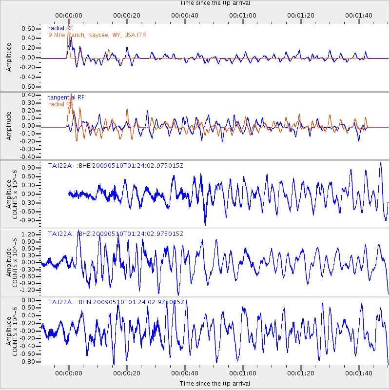
I22A 9 Mile Ranch, Kaycee, WY, USA - Earthquake Result Viewer
*The percent match for this event was below the threshold and hence no stack was calculated.
| Earthquake location: |
Off Coast Of Ecuador |
| Earthquake latitude/longitude: |
1.4/-85.2 |
| Earthquake time(UTC): |
2009/05/10 (130) 01:16:06 GMT |
| Earthquake Depth: |
6.0 km |
| Earthquake Magnitude: |
5.5 MB, 5.7 MS, 6.1 MW, 6.1 MW |
| Earthquake Catalog/Contributor: |
WHDF/NEIC |
|
| Network: |
TA USArray Transportable Network (new EarthScope stations) |
| Station: |
I22A 9 Mile Ranch, Kaycee, WY, USA |
| Lat/Lon: |
43.89 N/106.48 W |
| Elevation: |
1430 m |
|
| Distance: |
46.4 deg |
| Az: |
338.711 deg |
| Baz: |
149.864 deg |
| Ray Param: |
$rayparam |
*The percent match for this event was below the threshold and hence was not used in the summary stack. |
|
| Radial Match: |
66.73376 % |
| Radial Bump: |
325 |
| Transverse Match: |
65.76015 % |
| Transverse Bump: |
391 |
| SOD ConfigId: |
2760 |
| Insert Time: |
2010-03-06 03:38:02.191 +0000 |
| GWidth: |
2.5 |
| Max Bumps: |
400 |
| Tol: |
0.001 |
|
Signal To Noise
| Channel | StoN | STA | LTA |
| TA:I22A: :BHZ:20090510T01:24:02.975015Z | 3.1857834 | 5.4544836E-7 | 1.7121326E-7 |
| TA:I22A: :BHN:20090510T01:24:02.975015Z | 0.88380307 | 2.5360632E-7 | 2.8694888E-7 |
| TA:I22A: :BHE:20090510T01:24:02.975015Z | 1.2394238 | 2.2476476E-7 | 1.8134617E-7 |
| Arrivals |
| Ps | |
| PpPs | |
| PsPs/PpSs | |


