You are here: Home > Network List > TA - USArray Transportable Network (new EarthScope stations) Stations List
> Station D23K Nanushuk River, AK USA > Earthquake Result Viewer
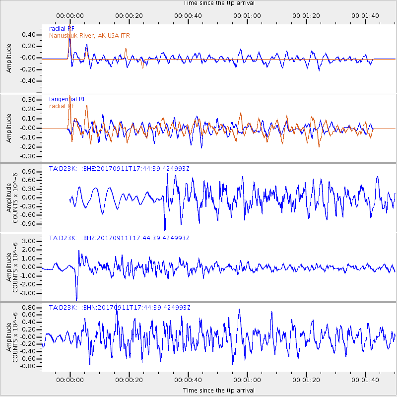
D23K Nanushuk River, AK USA - Earthquake Result Viewer
*The percent match for this event was below the threshold and hence no stack was calculated.
| Earthquake location: |
Volcano Islands, Japan Region |
| Earthquake latitude/longitude: |
24.0/142.3 |
| Earthquake time(UTC): |
2017/09/11 (254) 17:35:09 GMT |
| Earthquake Depth: |
35 km |
| Earthquake Magnitude: |
5.7 Mww |
| Earthquake Catalog/Contributor: |
NEIC PDE/us |
|
| Network: |
TA USArray Transportable Network (new EarthScope stations) |
| Station: |
D23K Nanushuk River, AK USA |
| Lat/Lon: |
68.97 N/150.68 W |
| Elevation: |
406 m |
|
| Distance: |
59.6 deg |
| Az: |
22.653 deg |
| Baz: |
257.423 deg |
| Ray Param: |
$rayparam |
*The percent match for this event was below the threshold and hence was not used in the summary stack. |
|
| Radial Match: |
69.7927 % |
| Radial Bump: |
400 |
| Transverse Match: |
69.80385 % |
| Transverse Bump: |
400 |
| SOD ConfigId: |
13570011 |
| Insert Time: |
2019-04-28 18:37:46.596 +0000 |
| GWidth: |
2.5 |
| Max Bumps: |
400 |
| Tol: |
0.001 |
|
Signal To Noise
| Channel | StoN | STA | LTA |
| TA:D23K: :BHZ:20170911T17:44:39.424993Z | 5.672658 | 1.2187168E-6 | 2.1484051E-7 |
| TA:D23K: :BHN:20170911T17:44:39.424993Z | 1.5338265 | 1.7062054E-7 | 1.11238485E-7 |
| TA:D23K: :BHE:20170911T17:44:39.424993Z | 1.6725048 | 3.6909168E-7 | 2.20682E-7 |
| Arrivals |
| Ps | |
| PpPs | |
| PsPs/PpSs | |


